Home » World Maps » Africa » Nigeria
Nigeria Map and Satellite Image
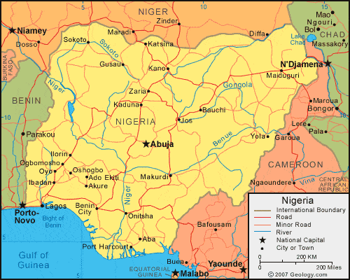
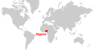
| Nigeria is located in western Africa. Nigeria is bordered by the Gulf of Guinea, Benin to the west, Niger to the north, and Chad and Cameroon to the east. |
ADVERTISEMENT
Nigeria Bordering Countries:
Benin, Cameroon, Chad, NigerRegional Maps:
Map of Africa, World MapWhere is Nigeria?
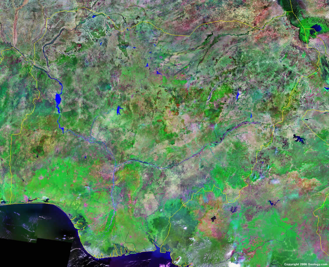
Nigeria Satellite Image
ADVERTISEMENT

Explore Nigeria Using Google Earth:
Google Earth is a free program from Google that allows you to explore satellite images showing the cities and landscapes of Nigeria and all of Africa in fantastic detail. It works on your desktop computer, tablet, or mobile phone. The images in many areas are detailed enough that you can see houses, vehicles and even people on a city street. Google Earth is free and easy-to-use.
Nigeria on a World Wall Map:
Nigeria is one of nearly 200 countries illustrated on our Blue Ocean Laminated Map of the World. This map shows a combination of political and physical features. It includes country boundaries, major cities, major mountains in shaded relief, ocean depth in blue color gradient, along with many other features. This is a great map for students, schools, offices and anywhere that a nice map of the world is needed for education, display or decor.
Nigeria On a Large Wall Map of Africa:
If you are interested in Nigeria and the geography of Africa our large laminated map of Africa might be just what you need. It is a large political map of Africa that also shows many of the continent's physical features in color or shaded relief. Major lakes, rivers, cities, roads, country boundaries, coastlines and surrounding islands are all shown on the map.Nigeria Cities:
Aba, Abuja, Ado Ekiti, Akure, Awka, Bauchi, Benin City, Gusau, Ibadan, Ilorin, Jos, Kaduna, Kano, Katsina, Kumo, Lafia, Lagos, Lagos, Maiduguri, Makurdi, Mubi, Ogbomosho, Onitsha, Orlu, Oshogbo, Owo, Oyo, Port Harcourt, Shaki, Sokoto, Yola and Zaria.Nigeria Locations:
Benue River, Bight of Benin, Bight of Bonny, Gongola River, Gulf of Guinea, Kaduna River, Kainji Lake, Mandara Mountains, Niger River, Sokoto River, Taraba River, Teshi River and Zamfara River.Nigeria Natural Resources:
Nigeria has fossil fuels deposits which include natural gas, petroleum and coal. Iron ore, niobium, lead, tin and zinc are some of the metal resources. The other natural resources include limestone and arable land.Nigeria Natural Hazards:
The country of Nigeria has some natural hazards, including periodic droughts and floods.Nigeria Environmental Issues:
Nigeria has a number of environmental issues. The country has had rapid deforestation and urbanization, as well as a loss of arable land, soil degradation and desertification. There is air and water pollution in urban areas; plus the country's water, air and soil have all suffered serious damage from oil spills.
ADVERTISEMENT