Home » World Maps » Africa » Republic of the Congo
Republic of the Congo Map and Satellite Image
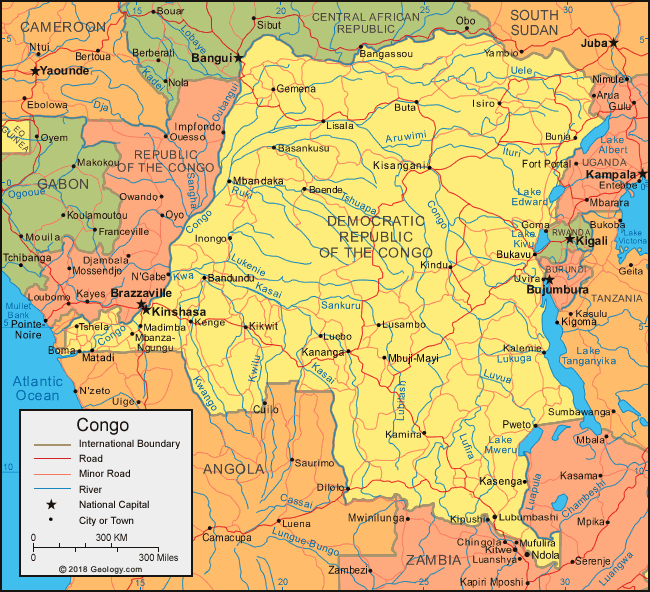
| The Republic of the Congo is located in central Africa. The Republic of the Congo is bordered by the Atlantic Ocean and Gabon to the west, Cameroon and the Central African Republic to the north, Angola to the south, and the Democratic Republic of the Congo to the east.
The Congo River forms much of the international boundary between the Republic of the Congo and its larger neighbor to the east, the Democratic Republic of the Congo. The Congo River also flows between the countries' twin capital cities of Brazzaville and Kinshasa, respectively. For this reason, the Republic of the Congo is sometimes referred to as "Congo-Brazzaville", and the Democratic Republic of the Congo is sometimes referred to as "Congo-Kinshasa". |
ADVERTISEMENT
Republic of the Congo Bordering Countries:
Angola, Cameroon, Central African Republic, Democratic Republic of the Congo, GabonRegional Maps:
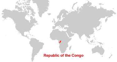
Map of Africa, World MapWhere is the Republic of the Congo?
Republic of the Congo Satellite Image

ADVERTISEMENT

Explore Republic of the Congo Using Google Earth:
Google Earth is a free program from Google that allows you to explore satellite images showing the cities and landscapes of Republic of the Congo and all of Africa in fantastic detail. It works on your desktop computer, tablet, or mobile phone. The images in many areas are detailed enough that you can see houses, vehicles and even people on a city street. Google Earth is free and easy-to-use.
Republic of the Congo on a World Wall Map:
Republic of the Congo is one of nearly 200 countries illustrated on our Blue Ocean Laminated Map of the World. This map shows a combination of political and physical features. It includes country boundaries, major cities, major mountains in shaded relief, ocean depth in blue color gradient, along with many other features. This is a great map for students, schools, offices and anywhere that a nice map of the world is needed for education, display or decor.
Republic of the Congo On a Large Wall Map of Africa:
If you are interested in Republic of the Congo and the geography of Africa our large laminated map of Africa might be just what you need. It is a large political map of Africa that also shows many of the continent's physical features in color or shaded relief. Major lakes, rivers, cities, roads, country boundaries, coastlines and surrounding islands are all shown on the map.Republic of the Congo Cities:
Brazzaville, Djambala, Ekouamou, Epena, Gamboma, Ikelemba, Impfondo, Kayes, Lekana, Loubomo, Makoua, Mobenzele, Mogandia, Mossaka, Mossendjo, Mouali, N'Gabe, Ouesso, Owando, Oyo, Pangala, Pikounda, Port-Noire and Zanaga.Republic of the Congo Locations:
Aina River, Alima River, Atlantic Ocean, Congo River, Djoue River, Ibenga River, Kandeko River, Kouilou River, Kouyou River, Lengoue River, Likouala aux Herbes River, Likouala River, Mambili (Opa) River, Motaba River, Nkeni River, Ngoko River, Niari River, Oubangui River and Sangha River.Republic of the Congo Natural Resources:
The metal and metallic deposits in Republic of the Congo include lead, zinc, copper, uranium, magnesium and gold. Some of the country's fuel resources are petroleum, natural gas and hydropower. Other natural resources include potash, phosphates and timber.Republic of the Congo Natural Hazards:
The natural hazards for the Republic of the Congo include seasonal flooding.Republic of the Congo Environmental Issues:
The environmental issues for the country of Republic of the Congo include water pollution from the dumping of raw sewage, and the tap water is not potable. There is air pollution from vehicle emissions. The country also has deforestation.
ADVERTISEMENT