Home » US Maps » Minnesota » Roads and Cities
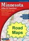
Map of Minnesota Cities and Roads

ADVERTISEMENT
City Maps for Neighboring States:
Iowa North Dakota South Dakota Wisconsin


Minnesota Cities:
Cities with populations over 10,000 include: Albert Lea, Austin, Bemidji, Bloomington, Brainerd, Brooklyn Park, Burnsville, Cloquet, Coon Rapids, Duluth, Eagan, East Bethel, Eden Prairie, Elk River, Fairmont, Faribault, Fergus Falls, Hastings, Hibbing, Hutchinson, Lakeville, Mankato, Marshall, Minneapolis, Minnetonka, Moorhead, New Ulm, North Mankato, Northfield, Owatonna, Plymouth, Red Wing, Rochester, Saint Cloud, Saint Paul, Willmar and Winona.
Minnesota Interstates:
North-South interstates include: Interstate 35. East-West interstates include: Interstate 90 and Interstate 94.
Minnesota Routes:
US Highways and State Routes include: Route 2, Route 10, Route 12, Route 14, Route 52, Route 53, Route 59, Route 61, Route 63, Route 71, Route 75, Route 169, Route 212 and Route 218.
ADVERTISEMENT

