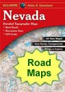
geology

Home » US Maps » Nevada Maps » Nevada Roads and Cities Map

Map of Nevada Cities - Nevada Road Map


map of Nevada cities

Road Maps of Nearby States:

Arizona   California   Idaho   Oregon   Utah  

Nevada DeLorme Atlas Nevada
Road Atlas
Detailed road maps, including back roads, for an entire state in a single convenient book. Get one for your next trip!
  Nevada wall map
Nevada
Wall Map
 
Terrain Navigator mapping software Nevada
3D Topo Software
View, annotate and print detailed topographic maps for the entire state of Nevada. Terrain Navigator is the perfect tool for hikers, hunters and those who work in the field.
City Satellite Images
City satellite images

Nevada Cities:


Cities with populations over 10,000 include: Boulder City, Elko, Henderson, Las Vegas, Mesquite, North Las Vegas, Paradise, Sparks, Spring Valley and Sunrise Manor.

Nevada Interstates:


North-South interstates include: Interstate 15. East-West interstates include: Interstate 80.

Nevada Routes:


US Highways and State Routes include: Route 6, Route 50, Route 93, Route 93A, Route 95, Route 95A and Route 395.

Copyright information: The maps on this page were composed by Brad Cole of Geology.com. If you want to share these maps with others please link to this page. These maps are property of Geology.com and may not be used beyond our websites. They were created using data licensed from and copyright by Map Resources.
© 2005-2012 Geology.com. All Rights Reserved.
Images, code and content of this website are property of Geology.com. Use without permission is prohibited. Pages on this site are protected by Copyscape.