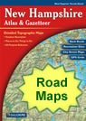
geology
Geology.com

Map of New Hampshire Cities - New Hampshire Road Map


map of New Hampshire cities
Free Download - High Resolution City Satellite Images

New Hampshire Cities

:
Cities with populations over 10,000 include: Berlin, Claremont, Derry, Dover, Keene, Laconia, Lebanon, Londonderry, Manchester, Nashua, Portsmouth, Rochester and Somersworth.

New Hampshire Interstates

:
North-South interstates include: Interstate 89, Interstate 93 and Interstate 95.

New Hampshire Routes

:
US Highways and State Routes include: Route 1, Route 2, Route 3, Route 4, Route 202 and Route 302.

Nearby States

:
Maine   Massachusetts   Vermont

Click a State for More Maps


clickable USA map
New Hampshire - More Information
new hampshire maps
new hampshire satellite map
News

Copyright information: The maps on this page were composed by Brad Cole of Geology.com. If you want to share these maps with others please link to this page. These maps are property of Geology.com © 2006 and may not be used beyond our websites. They were created using data licensed from and copyright by Map Resources © 2006.
© 2005-2008 Geology.com. All Rights Reserved.
Images, code and content of this website are property of Geology.com. Use without permission is prohibited. Pages on this site are protected by Copyscape.