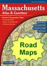
Home » US Maps » Massachusetts » Roads and Cities
Map of Massachusetts Cities and Roads

ADVERTISEMENT
City Maps for Neighboring States:
Connecticut New Hampshire New York Rhode Island Vermont


Massachusetts Cities:
Cities with populations over 10,000 include: Abington, Amesbury, Amherst, Attleboro, Barnstable, Beverly, Boston, Braintree, Brockton, Brookline, Burlington, Chicopee, Danvers, Dedham, Easthampton, Fall River, Fitchburg, Framingham, Franklin, Gardner, Gloucester, Greenfield, Haverhill, Holbrook, Holyoke, Hudson, Hull, Lawrence, Leominster, Longmeadow, Lowell, Lynn, Malden, Marblehead, Marlborough, Maynard, Medford, Methuen, Milford, New Bedford, Newburyport, Newton, North Adams, Northampton, Norwood, Pittsfield, Quincy, Randolph, Salem, Somerset, Somerville, South Yarmouth, Southbridge, Springfield, Taunton, Waltham, Webster, West Springfield, Westfield, Weymouth, Wilmington and Woburn.
Massachusetts Interstates:
North-South interstates include: Interstate 91, Interstate 93, Interstate 95, Interstate 395 and Interstate 495. East-West interstates include: Interstate 84 and Interstate 90.
Massachusetts Routes:
US Highways and State Routes include: Route 1, Route 3, Route 6, Route 7, Route 20, Route 44 and Route 202.
ADVERTISEMENT

