Home » US Maps » Vermont » Roads and Cities
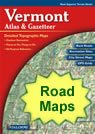
Map of Vermont Cities and Roads

ADVERTISEMENT
City Maps for Neighboring States:
Massachusetts New Hampshire New York


Vermont Cities:
Cities with populations over 10,000 include: Burlington, Rutland and South Burlington.
Vermont Interstates:
North-South interstates include: Interstate 89 and Interstate 91.
Vermont Routes:
US Highways and State Routes include: Route 2, Route 4, Route 5, Route 7and Route 302.
ADVERTISEMENT

