Home » US Maps » New Jersey » County Map
New Jersey County Map with County Seat Cities

ADVERTISEMENT
County Maps for Neighboring States:
Delaware New York Pennsylvania


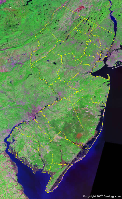
The map above is a Landsat satellite image of New Jersey with County boundaries superimposed. We have a more detailed satellite image of New Jersey without County boundaries.


ADVERTISEMENT
New Jersey Counties and County Seats |
|
|
Atlantic County - Mays Landing Bergen County - Hackensack Burlington County - Mount Holly Camden County - Camden Cape May County - Cape May Court House Cumberland County - Bridgeton Essex County - Newark Gloucester County - Woodbury Hudson County - Jersey City Hunterdon County - Flemington Mercer County - Trenton |
Middlesex County - New Brunswick Monmouth County - Freehold Borough Morris County - Morristown Ocean County - Toms River Passaic County - Paterson Salem County - Salem Somerset County - Somerville Sussex County - Newton Union County - Elizabeth Warren County - Belvidere |
