Home » US Maps » Idaho » Lakes and Rivers
Idaho Lakes, Rivers and Water Resources

ADVERTISEMENT
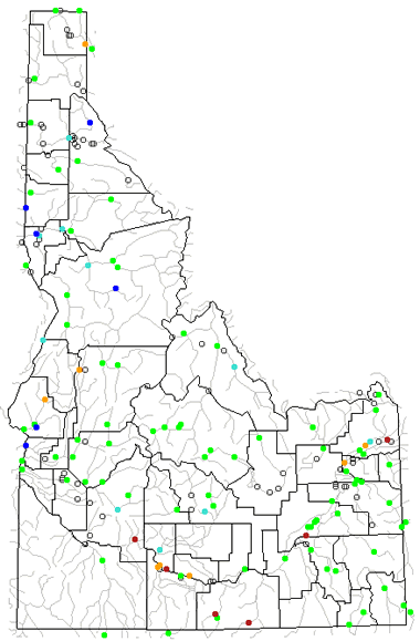
Idaho Rivers Shown on the Map: Bear River, Big Lost River, Boise River, Bruneau River, Clearwater River, Lemhi River, Lochsa River, Middle Fork Salmon River, Owyhee River, Payette River, Salmon River, Selway River, Snake River, St. Joe River and Weiser River.
Idaho Lakes Shown on the Map: American Falls Reservoir, Bear Lake, Blackfoot Reservoir, Cascade Reservoir, Coeur d'Alene Lake, Dworshak Reservoir, Grays Lake, Lake Walcott, Pend Oreille Lake and Priest Lake.
| Idaho Stream and River Levels |
 The United States Geological Survey has a number of stream gages located throughout Idaho. These estimate stream levels, discharges and record them over time. This data is published on the web and many stations allow users to plot custom graphs. Get updated Idaho river and stream levels from USGS here.
| Idaho Stream and River Level Alerts |
 The United States Geological Survey has a system that will send you an email message when flood levels are reached on any stream with USGS gaging equipment that you have selected. Sign up here to receive Idaho stream and river level alerts.

| Idaho Drought Map |
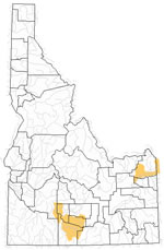 The United States Geological Survey publishes updated drought maps on their website. There you can view a map that shows where below normal 7-day average stream flow conditions were recently recorded. The maps are updated daily. Get a current Idaho drought map here.
| Idaho Water Publications |
 The United States Geological Survey has a number of publications related to water use and water resources in Idaho. Visit the Idaho Water Science Center here.
| Idaho Elevation Map |
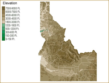 The topography of an area determines the direction of stream flow and often is a primary influence on the geographic distribution of precipitation. View a detailed Idaho elevation map.


Find Other Topics on Geology.com:

|

| ||

|

| ||

|

| ||

|

|