Home » US Maps » Rhode Island » Lakes and Rivers
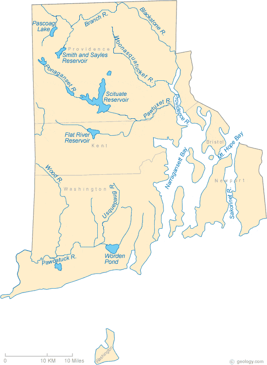
Rhode Island Lakes, Rivers and Water Resources
ADVERTISEMENT
Rhode Island Rivers Shown on the Map: Blackstone River, Branch River, Pawcatuck River, Pawtuxet River, Ponaganset River, Providence River, Sakonnet River, Usquepaug River, Wood River and Woonasquatucket River.
Rhode Island Lakes Shown on the Map: Flat River Reservoir, Mt. Hope Bay, Narragansett Bay, Pascoag Lake, Scituate Reservoir, Smith and Sayles Reservoir and Worden Pond.
| Rhode Island Stream and River Levels |
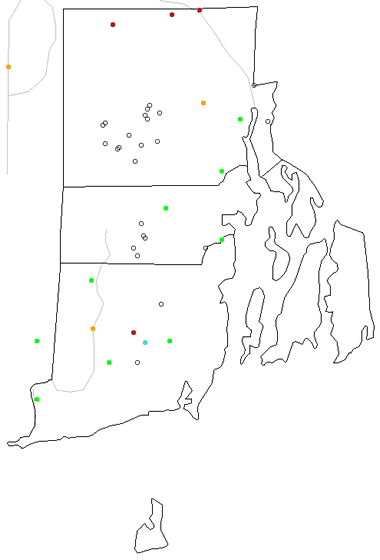 The United States Geological Survey has a number of stream gages located throughout Rhode Island. These estimate stream levels, discharges and record them over time. This data is published on the web and many stations allow users to plot custom graphs. Get updated Rhode Island river and stream levels from USGS here.
| Rhode Island Stream and River Level Alerts |
 The United States Geological Survey has a system that will send you an email message when flood levels are reached on any steam with USGS gaging equipment that you have selected. Sign up here to recieve Rhode Island stream and river level alerts.

| Rhode Island Drought Map |
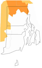 The United States Geological Survey publishes updated drought maps on their website. There you can view a map that shows where below normal 7-day average stream flow conditions were recently recorded. The maps are updated daily. Get a current Rhode Island drought map here.
| Rhode Island Water Publications |
 The United States Geological Survey has a number of publications related to water use and water resources in Rhode Island. Visit the New England Water Science Center here.
| Rhode Island Elevation Map |
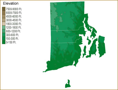 The topography of an area determines the direction of stream flow and often is a primary influence on the geographic distribution of precipitation. View a detailed Rhode Island elevation map.


Find Other Topics on Geology.com:

|

| ||

|

| ||

|

| ||

|

|