Home » Satellite Images » US States » Alabama
Satellite Image of Alabama
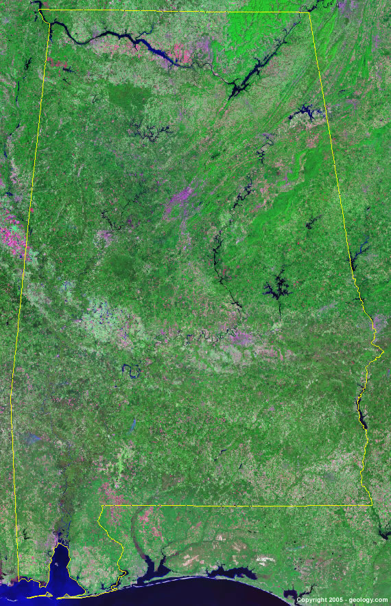
Alabama Satellite Image - View Cities, Rivers, Lakes & Environment
Satellite Images for Neighboring States:
Florida Georgia Mississippi TennesseeThis is a Landsat GeoCover 2000 satellite image map of Alabama. Cities, rivers, lakes, mountains and other features shown in this image include:
Alabama Cities:
Anniston, AL
Auburn, AL
Birmingham, AL
Decatur, AL
Dothan, AL
Florence, AL
Gadsden, AL
Huntsville, AL
Madison, AL
Mobile, AL
Montgomery, AL
Muscle Shoals, AL
Phenix City, AL
Sheffield, AL
Talladega, AL
Tuscaloosa, AL
Alabama Rivers, Lakes, Water Features:
Alabama River
Bankhead Lake
Big Creek Lake
Black Warrior River
Cedar Creek Reservoir
Chattahoochee River
Coosa River
Elk Lake
Gantt Lake
Guntersville Lake
Lake Eufaula
Lake Harding
Lake Jordan
Lake Martin
Lake Tuscaloosa
Lewis Smith Lake
Logan Martin Lake
Mitchell Lake
Mobile River
Neely Henry Lake
Tennessee River
Tom Bigby River
Walter F. George Reservoir
Weiss Lake
West Point Lake
Wheeler Lake
William Dannelly Reservoir
Wilson Lake
Other Prominent Alabama Features:
Alabama farm land
Little Mountains
Lookout Mountain
Mobile Bay
Rebecca Mountains
Red Mountain
Ripley Cuesta
Sand Mountain
ADVERTISEMENT
More Satellite Images
 State Satellite Images: Color Landsat views of all 50 states. Spectacular images.
 Use Google Earth for FREE: Browse seamless worldwide satellite images. Free.
 Earth from Space at Night: Composite images show worldwide patterns of night light and heat.
 Oil & Gas Fields from Space at Night: Drill pad lighting and flaring make them stand out at night.
 Country Satellite Images: Satellite images for over 170 countries from Landsat GeoCover data.
  Satellite Views of US Cities: Images of 120 cities and their surrounding environment.
 Land Below Sea Level: The top ten locations where land is below the level of the ocean.
  Satellite Views of 64 World Cities: Spectacular images showing the city and surrounding environment.
Copyright information: The images on this page were composed by Angela King and are copyright by Geology.com. These images are not available for use beyond our websites. If you would like to share them with others, please link to this page. The satellite image was produced using Landsat data from NASA.