Home » Satellite Images » US States » Oklahoma
Satellite Image of Oklahoma
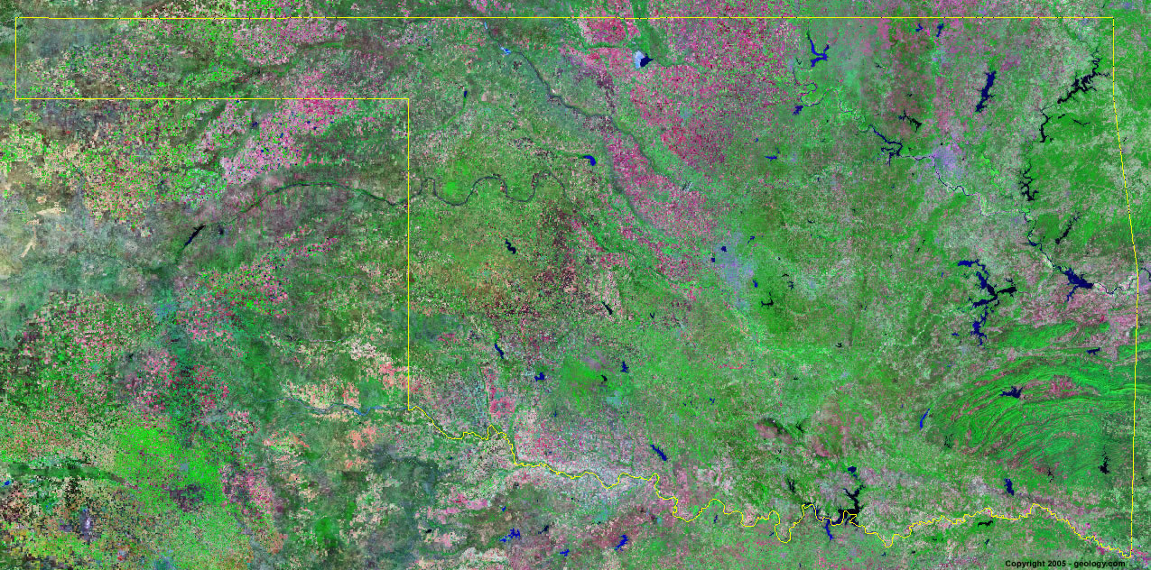
Oklahoma Satellite Image - View Cities, Rivers, Lakes & Environment
Satellite Images for Neighboring States:
Arkansas Colorado Kansas Missouri New Mexico TexasThis is a Landsat GeoCover 2000 satellite image map of Oklahoma. Cities, rivers, lakes, mountains and other features shown in this image include:
Oklahoma Cities:
Broken Arrow, OK
Enid, OK
Lawton, OK
Muskogee, OK
Norman, OK
Oklahoma City, OK
Ponca City, OK
Stillwater, OK
Tulsa, OK
Oklahoma Rivers, Lakes, Water Features:
Arkansas River
Broken Bow Lake
Canadian River
Canton Lake
Cimarron River
Eufaula Lake
Foss Lake
Ft. Cobb Reservoir
Ft. Gibson Lake
Gibson Lake
Great Salt Plains Lake
Kaw Lake
Keystone Lake
Lake Hudson
Lake O' the Cherokees
Lake Texoma
Oologah Lake
Red River
Robert S. Kerr Lake
Sardis Lake
Skiatook Lake
Sooner Lake
Tenkiller Ferry Lake
Waurika Lake
Other Prominent Oklahoma Features:
Kiamichi Mountains
Oklahoma farm land
Ouachita Mountains
ADVERTISEMENT
More Satellite Images
 State Satellite Images: Color Landsat views of all 50 states. Spectacular images.
 Use Google Earth for FREE: Browse seamless worldwide satellite images. Free.
 Earth from Space at Night: Composite images show worldwide patterns of night light and heat.
 Oil & Gas Fields from Space at Night: Drill pad lighting and flaring make them stand out at night.
 Country Satellite Images: Satellite images for over 170 countries from Landsat GeoCover data.
  Satellite Views of US Cities: Images of 120 cities and their surrounding environment.
 Land Below Sea Level: The top ten locations where land is below the level of the ocean.
  Satellite Views of 64 World Cities: Spectacular images showing the city and surrounding environment.
Copyright information: The images on this page were composed by Angela King and are copyright by Geology.com. These images are not available for use beyond our websites. If you would like to share them with others, please link to this page. The satellite image was produced using Landsat data from NASA.