Home » Satellite Images » US States » Oregon
Satellite Image of Oregon
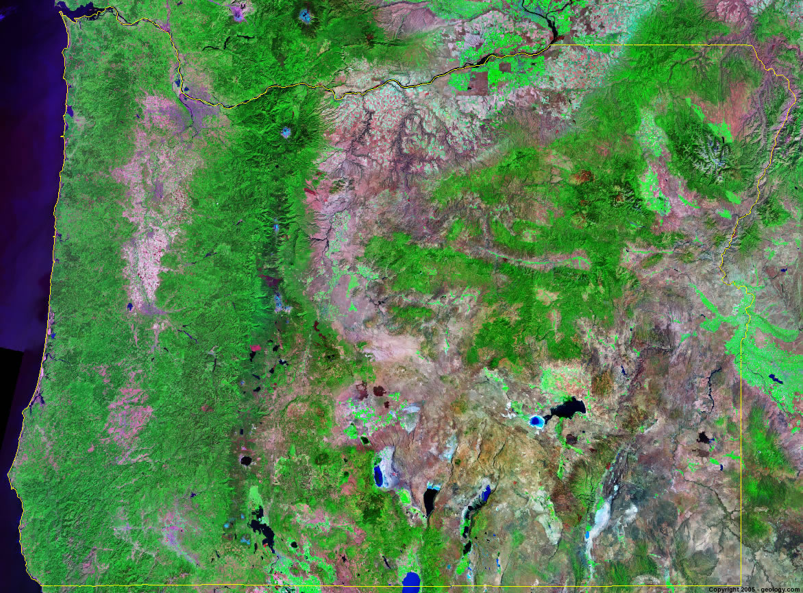
Oregon Satellite Image - View Cities, Rivers, Lakes & Environment
Satellite Images for Neighboring States:
California Idaho Nevada WashingtonThis is a Landsat GeoCover 2000 satellite image map of Oregon. Cities, rivers, lakes, mountains and other features shown in this image include:
Oregon Cities:
Albany, OR
Beaverton, OR
Bend, OR
Coos Bay, OR
Corvallis, OR
Eugene, OR
Hillsboro, OR
Medford, OR
Portland, OR
Salem, OR
Oregon Rivers, Lakes, Water Features:
Columbia River
Crater Lake
Crump Lake
Deschutes River
Fern Ridge Lake
Goose Lake
Harney Lake
Hart Lake
John Day River
Lake Abert
Malheur Lake
Owyhee River
Silver Lake
Snake River
Summer Lake
Upper Klamath Lake
Waldo Lake
Wickiup Reservoir
Willamette River
Other Prominent Oregon Features:
Aldrich Mountains
Blue Mountains
Cascade Mountain Range
Hells Canyon
Klamath Mountains
Mount Hood
Oregon farm land
Steens Mountain
Trout Creek Mountains
Wallowa Mountains
ADVERTISEMENT
More Satellite Images
 State Satellite Images: Color Landsat views of all 50 states. Spectacular images.
 Use Google Earth for FREE: Browse seamless worldwide satellite images. Free.
 Earth from Space at Night: Composite images show worldwide patterns of night light and heat.
 Oil & Gas Fields from Space at Night: Drill pad lighting and flaring make them stand out at night.
 Country Satellite Images: Satellite images for over 170 countries from Landsat GeoCover data.
  Satellite Views of US Cities: Images of 120 cities and their surrounding environment.
 Land Below Sea Level: The top ten locations where land is below the level of the ocean.
  Satellite Views of 64 World Cities: Spectacular images showing the city and surrounding environment.
Copyright information: The images on this page were composed by Angela King and are copyright by Geology.com. These images are not available for use beyond our websites. If you would like to share them with others, please link to this page. The satellite image was produced using Landsat data from NASA.