Home » Satellite Images » US States » Texas
Satellite Image of Texas
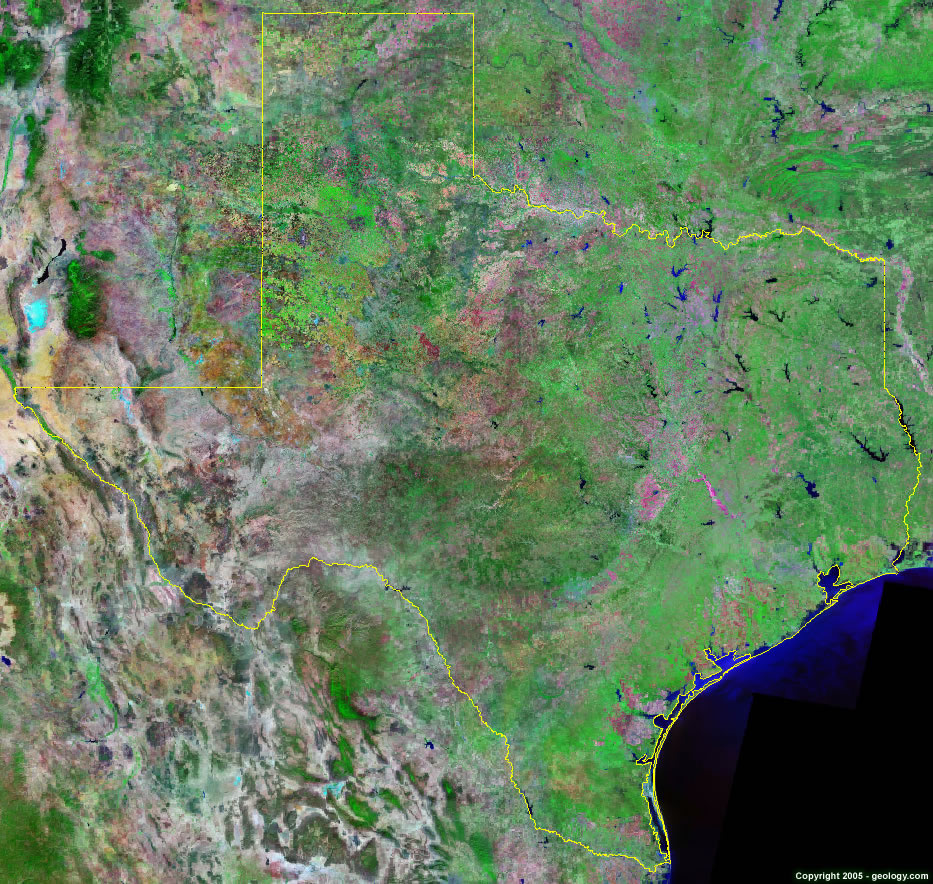
Texas Satellite Image - View Cities, Rivers, Lakes & Environment
Satellite Images for Neighboring States:
Arkansas Louisiana New Mexico OklahomaThis is a Landsat GeoCover 2000 satellite image map of Texas. Cities, rivers, lakes, mountains and other features shown in this image include:
Texas Cities:
Abilene, TX
Amarillo, TX
Austin, TX
Beaumont, TX
Corpus Christi, TX
Dallas, TX
El Paso, TX
Fort Worth, TX
Houston, TX
Laredo, TX
Longview, TX
Lubbock, TX
McAllen, TX
Midland, TX
Odessa, TX
Pasadena, TX
San Antonio, TX
Tyler, TX
Victoria, TX
Waco, TX
Texas Rivers, Lakes, Water Features:
Amistad Reservoir
Brazos River
Canadian River
Choke Canyon Reservoir
Colorado River
Lake Conroe
Lake Dallas
Lake Kemp
Lake Limestone
Lake Livingston
Lake Meredith
Lake of the PinesLake O. H. Ivie
Lake Tawakoni
Neches River
Nueces River
Pease River
Ray Roberts Lake
Red Bluff Lake
Red River
Rio Grande River
Sabine River
Sam Rayburn Reservoir
San Antonio River
South Guadalupe River
Toledo Bend Reservoir
Trinity River
Other Prominent Texas Features:
Baffin Bay
Barilla Mountains
Chinati Mountains
Christmas Mountains
Corpus Christi Bay
Davis Mountains
Del Norte Mountains
Delaware Mountains
Devil Ridge
Eagle Mountains
East Bay
Finlay Mountains
Galveston Bay
Glass Mountains
Hueco Mountains
Laguna Madre
Matagorda Bay
Quitman Mountains
Salt Basin
San Antonio Bay
Santiago Mountains
Sierra Diablo
Sierra Vieja
Texas farm land
Van Horn Mountains
West Bay
ADVERTISEMENT
More Satellite Images
 State Satellite Images: Color Landsat views of all 50 states. Spectacular images.
 Use Google Earth for FREE: Browse seamless worldwide satellite images. Free.
 Earth from Space at Night: Composite images show worldwide patterns of night light and heat.
 Oil & Gas Fields from Space at Night: Drill pad lighting and flaring make them stand out at night.
 Country Satellite Images: Satellite images for over 170 countries from Landsat GeoCover data.
  Satellite Views of US Cities: Images of 120 cities and their surrounding environment.
 Land Below Sea Level: The top ten locations where land is below the level of the ocean.
  Satellite Views of 64 World Cities: Spectacular images showing the city and surrounding environment.
Copyright information: The images on this page were composed by Angela King and are copyright by Geology.com. These images are not available for use beyond our websites. If you would like to share them with others, please link to this page. The satellite image was produced using Landsat data from NASA.