Home » US Maps » Nebraska Maps
Nebraska Map Collection
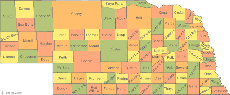
Nebraska County Map:
This map shows Nebraska's 93 counties. Also available is a detailed Nebraska County Map with county seat cities.
ADVERTISEMENT


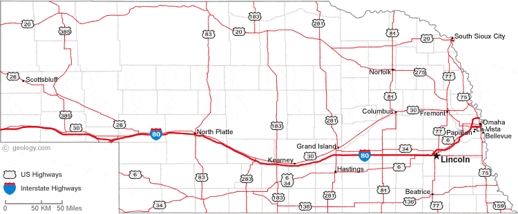
Map of Nebraska Cities:
This map shows many of Nebraska's important cities and most important roads. The important east - west route is Interstate 80. We also have a more detailed Map of Nebraska Cities.
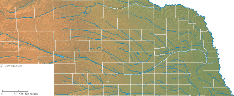
Nebraska Physical Map:
This Nebraska shaded relief map shows the major physical features of the state. For other nice views of the state, see our Nebraska Satellite image or the Nebraska map by Google.
ADVERTISEMENT
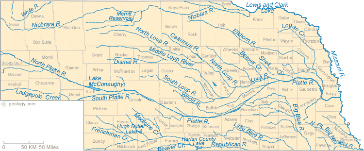
Nebraska Rivers Map:
This map shows the major streams and rivers of Nebraska and some of the larger lakes. Nebraska is in the Gulf of Mexico Watershed and the topography is a plain that gently slopes to the east. The rivers and streams follow this slope and mostly drain into the Missouri River which forms the eastern boundary of the state. Most of these lakes and streams can be clearly seen on the Nebraska Satellite Image. We also have a page about Nebraska water resources.
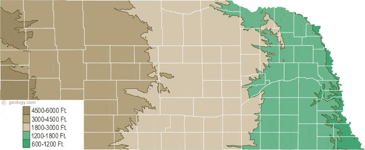
Nebraska Elevation Map:
This is a generalized topographic map of Nebraska. It shows elevation trends across the state. Detailed topographic maps and aerial photos of Nebraska are available in the Geology.com store. See our state high points map to learn about Panorama Point at 5,424 feet - the highest point in Nebraska. The lowest point is the Missouri River at 840 feet.