Home » US Maps » Nebraska » County Map
Nebraska County Map with County Seat Cities

ADVERTISEMENT
County Maps for Neighboring States:
Colorado Iowa Kansas Missouri South Dakota Wyoming
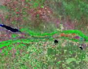


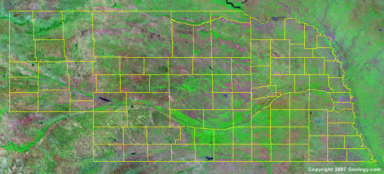
The map above is a Landsat satellite image of Nebraska with County boundaries superimposed. We have a more detailed satellite image of Nebraska without County boundaries.


ADVERTISEMENT
Nebraska Counties and County Seats |
|
|
Adams County - Hastings Antelope County - Neligh Arthur County - Arthur Banner County - Harrisburg Blaine County - Brewster Boone County - Albion Box Butte County - Alliance Boyd County - Butte Brown County - Ainsworth Buffalo County - Kearney Burt County - Tekamah Butler County - David City Cass County - Plattsmouth Cedar County - Hartington Chase County - Imperial Cherry County - Valentine Cheyenne County - Sidney Clay County - Clay Center Colfax County - Schuyler Cuming County - West Point Custer County - Broken Bow Dakota County - Dakota City Dawes County - Chadron Dawson County - Lexington Deuel County - Chappell Dixon County - Ponca Dodge County - Fremont Douglas County - Omaha Dundy County - Benkelman Fillmore County - Geneva Franklin County - Franklin Frontier County - Stockville Furnas County - Beaver City Gage County - Beatrice Garden County - Oshkosh Garfield County - Burwell Gosper County - Elwood Grant County - Hyannis Greeley County - Greeley Hall County - Grand Island Hamilton County - Aurora Harlan County - Alma Hayes County - Hayes Center Hitchcock County - Trenton Holt County - O'Neill Hooker County - Mullen Howard County - St. Paul |
Jefferson County - Fairbury Johnson County - Tecumseh Kearney County - Minden Keith County - Ogallala Keya Paha County - Springview Kimball County - Kimball Knox County - Center Lancaster County - Lincoln Lincoln County - North Platte Logan County - Stapleton Loup County - Taylor Madison County - Madison McPherson County - Tryon Merrick County - Central City Morrill County - Bridgeport Nance County - Fullerton Nemaha County - Auburn Nuckolls County - Nelson Otoe County - Nebraska City Pawnee County - Pawnee City Perkins County - Brant Phelps County - Holdrege Pierce County - Pierce Platte County - Columbus Polk County - Osceola Red Willow County - McCook Richardson County - Falls City Rock County - Bassett Saline County - Wilber Sarpy County - Papillion Saunders County - Wahoo Scotts Bluff County - Gering Seward County - Seward Sheridan County - Rushville Sherman County - Loup City Sioux County - Harrison Stanton County - Stanton Thayer County - Hebron Thomas County - Thedford Thurston County - Pender Valley County - Ord Washington County - Blair Wayne County - Wayne Webster County - Red Cloud Wheeler County - Bartlett York County - York |
