Home » Teaching Earth Science » Map and Geography Lesson Plans
Maps and Geography Classroom Activities and Lesson Plans
 |
Small Grants for Science Teachers A two-page proposal might win $200 to $600 in science supplies for your students. Thousands of teachers win these grants every year. DonorsChoose.org. |
 |
Free Graph Paper and Free Maps Your students can get free printable graph paper, printable maps, printable calendars and more at WaterproofPaper.com, a website affiliated with Geology.com. |
| National Science Teachers Association An organization providing resources, professional development, education conferences, and much more! |
 |
Associations for Science Teachers NSTA's list of science teaching societies in U.S. states and Canadian provinces. Find professional development near you. |
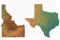 |
State Maps A collection of 250 reference maps for the 50 states. There is a county, physical, elevation, river, and city/roads map for every state. |
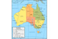 |
World maps A collection of political maps and Landsat images for over 160 world countries. These maps and satellite images can be an important reference for geography and earth science. |
ADVERTISEMENT
 |
Satellite Images Satellite images are great resources to use for teaching. Lesson plans, projects, and classroom activities can easily be made using satellite images. |
| More Geology Topics |
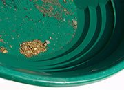 |
Gold |
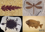 |
Fossils |
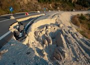 |
Landslides |
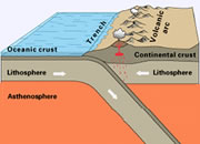 |
Plate Tectonics |
 |
Topo Maps |
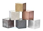 |
Metals |
 |
Gifts That Rock |
 |
General Geology |
 |
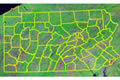
Maps This lesson plan requires students to look at maps, color maps, and interpret maps according to the teacher's directions. This project uses Pennsylvania maps, but any state would work. With minor modifications, this classroom activity can be beneficial for all students. |
|
Small Grants for Science Teachers A two-page proposal might win $200 to $600 in science supplies for your students. Thousands of teachers win these grants every year. DonorsChoose.org. |
|
Free Graph Paper and Free Maps Your students can get free printable graph paper, printable maps, printable calendars and more at WaterproofPaper.com, a website affiliated with Geology.com. |
| National Science Teachers Association An organization providing resources, professional development, education conferences, and much more! |
|
Associations for Science Teachers NSTA's list of science teaching societies in U.S. states and Canadian provinces. Find professional development near you. |
| More Geology Topics |
| |
Gold |
| |
Fossils |
| |
Landslides |
| |
Plate Tectonics |
| |
Topo Maps |
| |
Metals |
| |
Gifts That Rock |
| |
General Geology |

Find Other Topics on Geology.com:

|

| ||

|

| ||
|

| ||

|

|