Home » US Maps » Minnesota Maps » Minnesota Physical Map
Minnesota Physical Map
ADVERTISEMENT
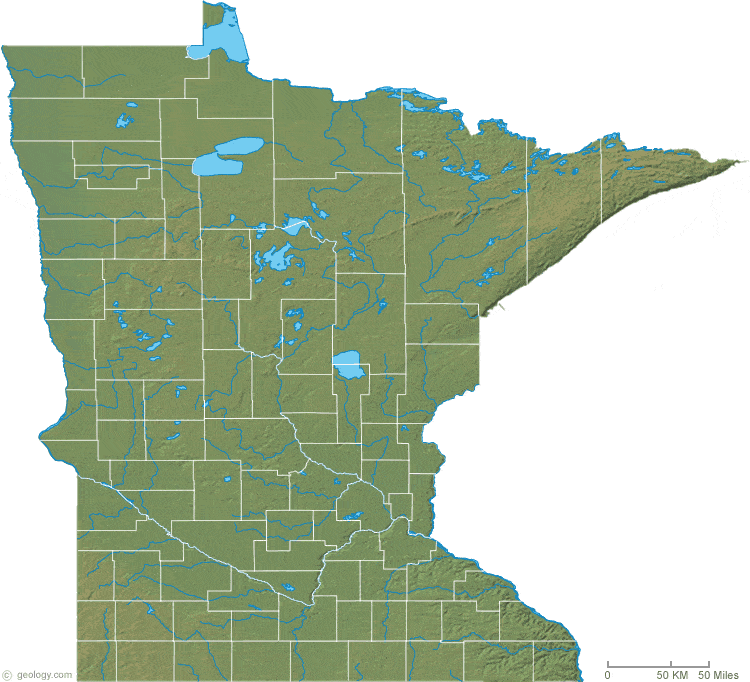
Minnesota Physical Relief Map:
This Minnesota shaded relief map shows the major physical features of the state. For another nice view of the state, see our Minnesota Satellite image.


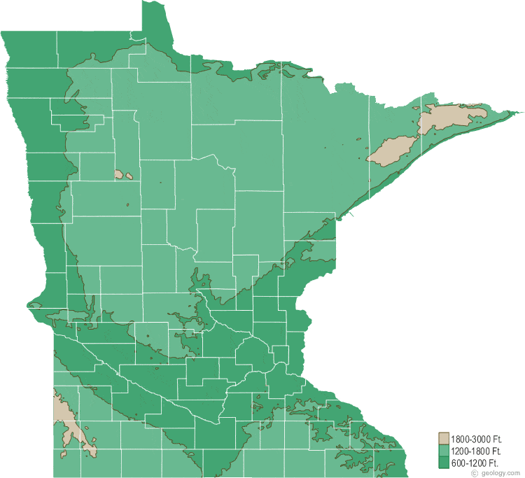
Minnesota Topographic Map:
This is a generalized topographic map of Minnesota. It shows elevation trends across the state. Detailed topographic maps and aerial photos of Minnesota are available in the Geology.com store. See our state high points map to learn about Eagle Mtn. at 2,301 feet - the highest point in Minnesota. The lowest point is Lake Superior at 601 feet.
ADVERTISEMENT