Home » US Maps » Montana Maps » Montana Physical Map
Montana Physical Map

ADVERTISEMENT
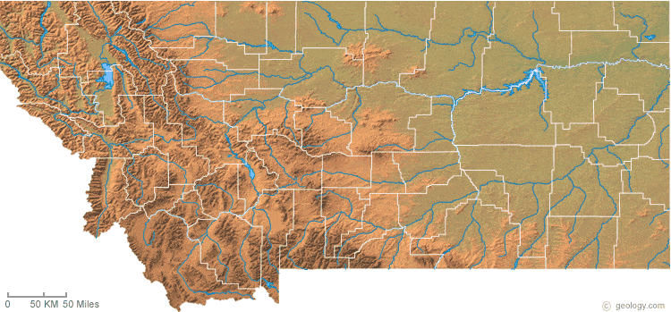
Montana Physical Relief Map:
This Montana shaded relief map shows the major physical features of the state. For another nice view of the state, see our Montana Satellite image.

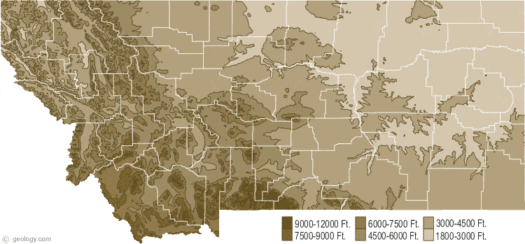
Montana Topographic Map:
This is a generalized topographic map of Montana. It shows elevation trends across the state. Detailed topographic maps and aerial photos of Montana are available in the Geology.com store. See our state high points map to learn about Granite Peak at 12,799 feet - the highest point in Montana. The lowest point is the Kootenai River at 1,800 feet.
ADVERTISEMENT
Copyright information: The maps on this page were composed by Brad Cole of Geology.com. If you want to share these maps with others please link to this page. These maps are property of Geology.com and may not be used beyond our websites. They were created using data licensed from and copyright by Map Resources.


