Home » World Maps » Africa » Burundi
Burundi Map and Satellite Image
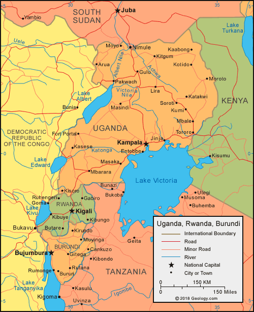
| Burundi is located in central Africa. Burundi is bordered by Lake Tanganyika and the Democratic Republic of the Congo to the west, Tanzania to the east, and Rwanda to the north.
In 2019, the Burundian parliament decided that although Bujumbura would remain the economic capital of the country and its center of commerce, the political capital would be moved back to Gitega, as Gitega has a better, more central location. However, as of September 2024, the move has not yet been completed. |
ADVERTISEMENT
Burundi Bordering Countries:
Democratic Republic of the Congo, Rwanda, TanzaniaRegional Maps:
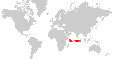
Map of Africa, World MapWhere is Burundi?
Burundi Satellite Image

ADVERTISEMENT

Explore Burundi Using Google Earth:
Google Earth is a free program from Google that allows you to explore satellite images showing the cities and landscapes of Burundi and all of Africa in fantastic detail. It works on your desktop computer, tablet, or mobile phone. The images in many areas are detailed enough that you can see houses, vehicles and even people on a city street. Google Earth is free and easy-to-use.
Burundi on a World Wall Map:
Burundi is one of nearly 200 countries illustrated on our Blue Ocean Laminated Map of the World. This map shows a combination of political and physical features. It includes country boundaries, major cities, major mountains in shaded relief, ocean depth in blue color gradient, along with many other features. This is a great map for students, schools, offices and anywhere that a nice map of the world is needed for education, display or decor.
Burundi On a Large Wall Map of Africa:
If you are interested in Burundi and the geography of Africa our large laminated map of Africa might be just what you need. It is a large political map of Africa that also shows many of the continent's physical features in color or shaded relief. Major lakes, rivers, cities, roads, country boundaries, coastlines and surrounding islands are all shown on the map.Burundi Cities:
Bujumbura, Bururi, Cankuzo, Gitega, Kirundo, Muramvya, Muyinga, Ngozi, Nyanza Lac, Rumonge, Rutana and Ruyigi.Burundi Locations:
Lake Tanganyika.Burundi Natural Resources:
Burundi has diverse metal resources which include nickel, uranium, cobalt, copper, platinum, vanadium, niobium, tantalum, gold, tin and tungsten. Other natural resources include rare earth oxides, peat, arable land, hydropower, kaolin and limestone.Burundi Natural Hazards:
The country of Burundi experiences a variety of natural hazards. These include flooding, landslides, and drought.Burundi Environmental Issues:
The environmental issues for the country of Burundi are mostly land-related. There is soil erosion as a result of overgrazing and the expansion of agriculture into marginal lands. The country has little forested land remaining due to the uncontrolled cutting of trees for fuel. This habitat loss has in turn threatened their wildlife populations.
ADVERTISEMENT