Home » World Maps » Africa » Central African Republic
Central African Republic Map and Satellite Image
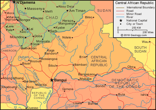
| The Central African Republic is located in central Africa. The Central African Republic is bordered by Cameroon to the west, Chad to the north, Sudan and South Sudan to the east, and to the south, the Republic of the Congo and Democratic Republic of the Congo. |
ADVERTISEMENT
Central African Republic Bordering Countries:
Cameroon, Chad, Democratic Republic of the Congo, Republic of the Congo, South Sudan, SudanRegional Maps:
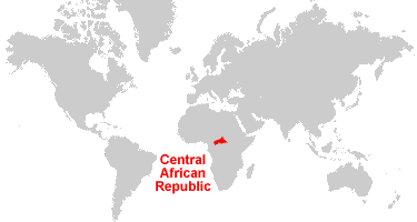
Map of Africa, World MapWhere is Central African Republic?
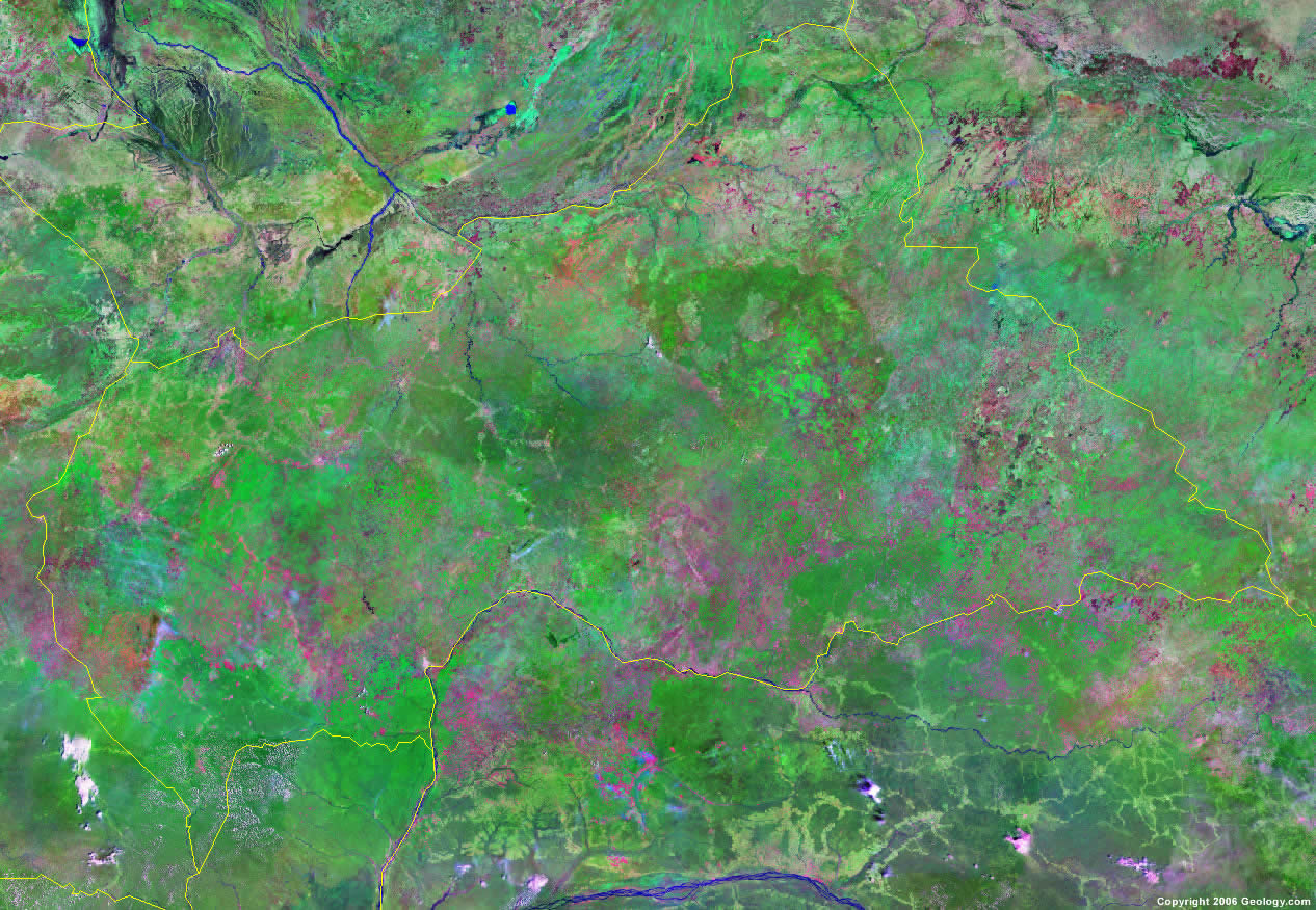
Central African Republic Satellite Image
ADVERTISEMENT

Explore Central African Republic Using Google Earth:
Google Earth is a free program from Google that allows you to explore satellite images showing the cities and landscapes of Central African Republic and all of Africa in fantastic detail. It works on your desktop computer, tablet, or mobile phone. The images in many areas are detailed enough that you can see houses, vehicles and even people on a city street. Google Earth is free and easy-to-use.
Central African Republic on a World Wall Map:
Central African Republic is one of nearly 200 countries illustrated on our Blue Ocean Laminated Map of the World. This map shows a combination of political and physical features. It includes country boundaries, major cities, major mountains in shaded relief, ocean depth in blue color gradient, along with many other features. This is a great map for students, schools, offices and anywhere that a nice map of the world is needed for education, display or decor.
Central African Republic On a Large Wall Map of Africa:
If you are interested in Central African Republic and the geography of Africa our large laminated map of Africa might be just what you need. It is a large political map of Africa that also shows many of the continent's physical features in color or shaded relief. Major lakes, rivers,cities, roads, country boundaries, coastlines and surrounding islands are all shown on the map.Central African Republic Cities:
Abba, Amada Gaza, Bangassou, Banguri, Bania, Berberati, Birao, Bossangoa, Bouar, Bozoum, Bria, Djema, Gadzi, Kabo, Kaga Bandoro, Kazima, Kerre, Mbaiki, Ndele, Ngoto, Nola, Obo, Ouando, Salo, Sibut and Zemio Yakotoko.Central African Republic Locations:
Bahr Aouk River, Bamingui River, Bangoul River, Goro River, Gribingui River, Kadei River, Kameur River, Kotto River, Lobaye River, Mbomou River, Manovo River, Oubangui River, Ouddjia River, Ouham River, Oulou River, Vakaga River, Vassako River and Yata River.Central African Republic Natural Resources:
Mineral resources of Central African Republic include diamonds, uranium, gold and oil. Other resources include timber and hydropower.Central African Republic Natural Hazards:
One of the natural hazards for Central African Republic is the hot, dry, dusty harmattan winds, which affects the northern areas. In addition, floods are common in this country.Central African Republic Environmental Issues:
The land-locked country of Central African Republic experiences deforestation and desertification. The tap water is not potable. Central African Republic's reputation as one of the last great wildlife refuges has diminished, due to poaching.
ADVERTISEMENT