Home » World Maps » Africa » Comoros Islands
Comoros Islands Map and Satellite Image
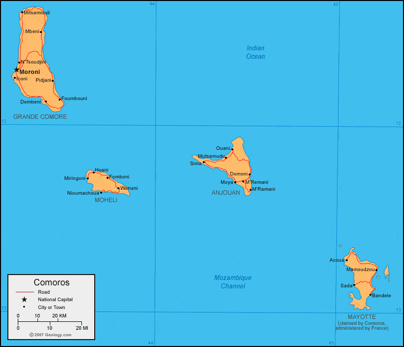
| The Comoros Islands are located in the Mozambique Channel of the Indian Ocean, off the east coast of Africa. They are roughly halfway between Mozambique and Madagascar. |
ADVERTISEMENT
Comoros Islands Neighboring Countries:
Madagascar, Mozambique, TanzaniaRegional Maps:
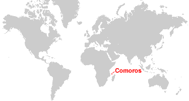
Map of Africa, World MapWhere are the Comoros Islands?
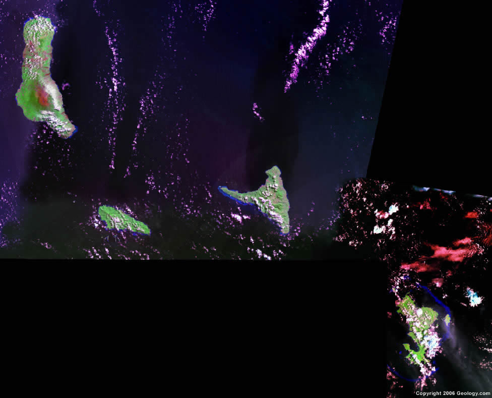
Comoros Islands Satellite Image
ADVERTISEMENT

Explore Comoros Islands Using Google Earth:
Google Earth is a free program from Google that allows you to explore satellite images showing the cities and landscapes of Comoros Islands and all of Africa in fantastic detail. It works on your desktop computer, tablet, or mobile phone. The images in many areas are detailed enough that you can see houses, vehicles and even people on a city street. Google Earth is free and easy-to-use.
Comoros Islands on a World Wall Map:
Comoros Islands is one of nearly 200 countries illustrated on our Blue Ocean Laminated Map of the World. This map shows a combination of political and physical features. It includes country boundaries, major cities, major mountains in shaded relief, ocean depth in blue color gradient, along with many other features. This is a great map for students, schools, offices and anywhere that a nice map of the world is needed for education, display or decor.
Comoros Islands On a Large Wall Map of Africa:
If you are interested in Comoros Islands and the geography of Africa our large laminated map of Africa might be just what you need. It is a large political map of Africa that also shows many of the continent's physical features in color or shaded relief. Major lakes, rivers,cities, roads, country boundaries, coastlines and surrounding islands are all shown on the map.Comoros Islands Cities:
Acoua, Bandele, Dembeni, Dzaoudzi, Fomboni, Foumbouni, Hoani, Iconi, Mamoudzou, Mbeni, Miringoni, Mitsamiouli, Moroni, Moya, M'Remani, Mutsamudu, Nioumachoua, N'Tsoudjini, Ouani, Pidjani, Sada, Sima and Wanani.Comoros Islands Locations:
Indian Ocean and Mozambique Channel.Comoros Islands Natural Resources:
Natural resources for Comoros include fish.Comoros Islands Natural Hazards:
From December to April, during the rainy season, cyclones are a possible natural hazard for the Comoros Islands. In addition, on the island of Grand Comore, is Le Kartala, an active volcano.Comoros Islands Environmental Issues:
Comoros Islands have soil degradation and erosion, which is the result of crop cultivation on slopes without proper terracing. There is also deforestation.
ADVERTISEMENT