Home » World Maps » Europe » Cyprus
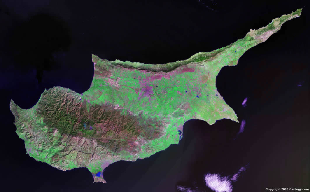
Cyprus Map and Satellite Image
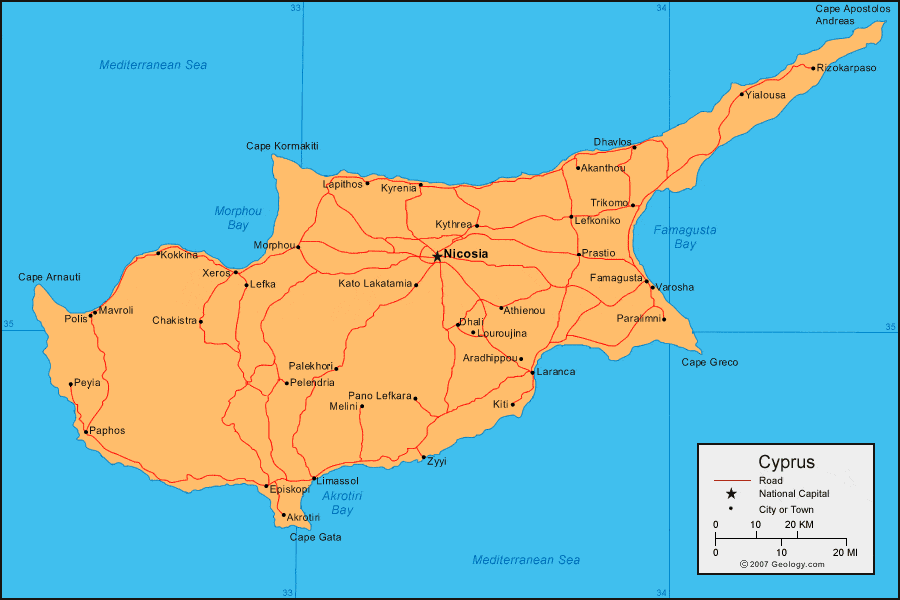
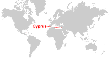
| Cyprus is an island in the Middle East. It is located in the Mediterranean Sea, south of Turkey. |
ADVERTISEMENT
Cyprus Neighboring Countries:
Turkey, SyriaRegional Maps:
Asia, Europe, Middle East, WorldWhere is Cyprus?
Cyprus Satellite Image
ADVERTISEMENT

Explore Cyprus Using Google Earth:
Google Earth is a free program from Google that allows you to explore satellite images showing the cities and landscapes of Cyprus and all of Europe in fantastic detail. It works on your desktop computer, tablet, or mobile phone. The images in many areas are detailed enough that you can see houses, vehicles and even people on a city street. Google Earth is free and easy-to-use.
Cyprus on a World Wall Map:
Cyprus is one of nearly 200 countries illustrated on our Blue Ocean Laminated Map of the World. This map shows a combination of political and physical features. It includes country boundaries, major cities, major mountains in shaded relief, ocean depth in blue color gradient, along with many other features. This is a great map for students, schools, offices and anywhere that a nice map of the world is needed for education, display or decor.
Cyprus On a Large Wall Map of Europe:
If you are interested in Cyprus and the geography of Europe our large laminated map of Europe might be just what you need. It is a large political map of Europe that also shows many of the continent's physical features in color or shaded relief. Major lakes, rivers, cities, roads, country boundaries, coastlines and surrounding islands are all shown on the map.Cyprus Cities:
Akanthou, Akrotiri, Ammochostos (Famagusta, Gazimagusa), Aradhippou, Athienou, Chakistra, Dhali, Dhavlos, Episkopi, Famagusta, Kato Lakatamia, Khirokitia, Kiti, Kokkina, Ktima, Kyrenia, Kythrea, Lapithos, Laranca, Larnaka, Lefkoniko, Lefkosia (Nicosia, Lefkosa), Lemesos (Limassol), Limassol, Louroujina, Mavroli, Melini, Morphou, Pafos, Palekhori, Pano Lefkara, Paphos, Paralimni, Pelendria, Peyla, Polis, Prastio, Rizokarpaso, Trikomo, Varosha, Xeros, Yialousa and Zyyi.Cyprus Locations:
Akrotiri Bay, Cape Apostolos Andreas, Cape Arnauti, Cape Gata, Cape Greco, Cape Kormakiti, Famagusta Bay, Mediterranean Sea and Morphou Bay.Cyprus Natural Resources:
The mineral resources in Cyprus include gypsum, pyrites, asbestos, copper, and clay earth pigments. Other resources include timber, salt, and marble.Cyprus Natural Hazards:
Cyprus has natural hazards which include droughts and moderate earthquake activity.Cyprus Environmental Issues:
Cyprus has a number of environmental issues concerning water. These issues include water pollution from sewage and industrial wastes, as well as coastal degradation. Numerous other problems complicate the water resources, such as: no natural reservoir catchments; seasonal disparity in rainfall; sea water intrusion to the island's largest aquifer; increased salination in the north. Urbanization has caused a loss of wildlife habitats.
ADVERTISEMENT