Home » World Maps » Asia » East Timor
East Timor Map and Satellite Image
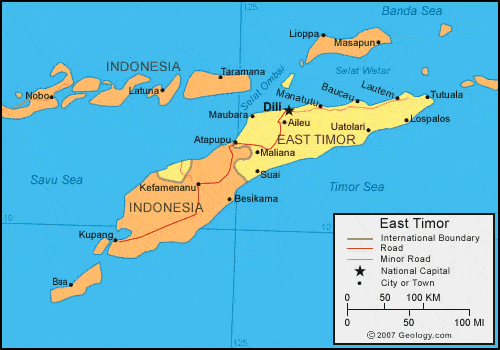
| East Timor, also called Timor-Leste, is located in southeastern Asia. The country shares the island of Timor with Indonesia. East Timor is bordered by the Savu Sea and the Timor Sea. |
ADVERTISEMENT
East Timor Bordering Countries:
IndonesiaRegional Maps:
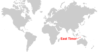
Map of Asia, World MapWhere is East Timor?
East Timor Satellite Image

ADVERTISEMENT

Explore East Timor Using Google Earth:
Google Earth is a free program from Google that allows you to explore satellite images showing the cities and landscapes of East Timor and all of Asia in fantastic detail. It works on your desktop computer, tablet, or mobile phone. The images in many areas are detailed enough that you can see houses, vehicles and even people on a city street. Google Earth is free and easy-to-use.
East Timor on a World Wall Map:
East Timor is one of nearly 200 countries illustrated on our Blue Ocean Laminated Map of the World. This map shows a combination of political and physical features. It includes country boundaries, major cities, major mountains in shaded relief, ocean depth in blue color gradient, along with many other features. This is a great map for students, schools, offices and anywhere that a nice map of the world is needed for education, display or decor.
East Timor On a Large Wall Map of Asia:
If you are interested in East Timor and the geography of Asia our large laminated map of Asia might be just what you need. It is a large political map of Asia that also shows many of the continent's physical features in color or shaded relief. Major lakes, rivers, cities, roads, country boundaries, coastlines and surrounding islands are all shown on the map.East Timor Cities:
Aileu, Atapupu, Baquia, Baucau, Dili, Lautem, Lospalos, Macassar (Oecusse), Maliana, Manatuto, Maubara, Suai, Tutuala, Uatolari and Viqueque.East Timor Locations:
Savu Sea, Selat Ombai, Selat Roti, Selat Wetar, Teluk Kupang and Timor Sea.East Timor Natural Resources:
The fuel resources in East Timor include petroleum and natural gas. Gold, manganese, and marble are other resources for East Timor.East Timor Natural Hazards:
Floods and landslides are common in East Timor. Other natural hazards include tropical cyclones, earthquakes, and tsunamis.East Timor Environmental Issues:
East Timor, in southeastern Asia, has environmental issues which link to their widespread use of slash and burn agriculture. This has led to deforestation and soil erosion.
ADVERTISEMENT