Home » World Maps » Asia » Indonesia
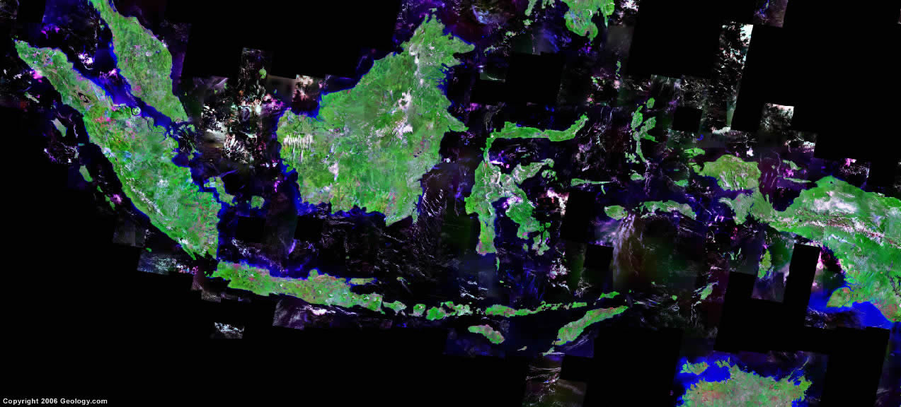
Indonesia Map and Satellite Image
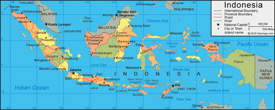
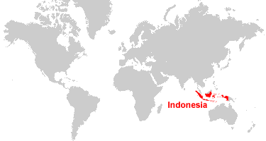
| Indonesia is located in southeastern Asia. It is a large group of islands bordered by many seas that lie between the Indian Ocean and the Pacific Ocean. The islands of Indonesia are part of the Malay archipelago. |
ADVERTISEMENT
Indonesia Bordering Countries:
East Timor, Malaysia, Papua New GuineaRegional Maps:
Map of Asia, World MapWhere is Indonesia?
Indonesia Satellite Image
ADVERTISEMENT

Explore Indonesia Using Google Earth:
Google Earth is a free program from Google that allows you to explore satellite images showing the cities and landscapes of Indonesia and all of Asia in fantastic detail. It works on your desktop computer, tablet, or mobile phone. The images in many areas are detailed enough that you can see houses, vehicles and even people on a city street. Google Earth is free and easy-to-use.
Indonesia on a World Wall Map:
Indonesia is one of nearly 200 countries illustrated on our Blue Ocean Laminated Map of the World. This map shows a combination of political and physical features. It includes country boundaries, major cities, major mountains in shaded relief, ocean depth in blue color gradient, along with many other features. This is a great map for students, schools, offices and anywhere that a nice map of the world is needed for education, display or decor.
Indonesia On a Large Wall Map of Asia:
If you are interested in Indonesia and the geography of Asia our large laminated map of Asia might be just what you need. It is a large political map of Asia that also shows many of the continent's physical features in color or shaded relief. Major lakes, rivers, cities, roads, country boundaries, coastlines and surrounding islands are all shown on the map.Indonesia Cities:
Balikpapan, Banda Aceh, Bandar Lampung, Bandung, Banjarmasin, Bengkulu, Bogor, Cirebon, Denpasar, Dumai, Garut, Jakarta, Jambi, Jayapura, Kebumen, Kediri, Kendawangan, Kupang, Langsa, Lhokseumawe, Lunjuk-Besar, Makassar, Malang, Manado, Manokwari, Medan, Padang, Pekanbaru, Palembang, Palu, Pati, Pekalongan, Pontianak, Probolinggo, Rantauprapa, Rengal, Samarinda, Semarang, Singkawang, Sintang, Sorong, Sukabumi, Surabaya, Tandjungredeb, Tanjung Selor, Tegal, and Yogyakarta.Indonesia Named Islands:
Bali, Borneo (Kalimantan is the Indonesian part of the island of Borneo), Buru, East Nusa Tenggara, Jamdena, Java, Komodo, Lombok, Maluku, New Guinea, North Maluku, Obi, Riau Islands, Sulawesi, Sumatra, Sumba, Taliabu, Timor, Trangan, and West Nusa Tenggara.Indonesia Locations:
Andaman Sea, Arafura Sea, Bali Sea, Banda Sea, Celebes Sea, Ceram Sea, Danau Poso Lake, Danau Ranau Lake, Danau Tempe Lake, Danau Toba, Danau Towuti Lake, Flores Sea, Indian Ocean, Java Sea, Makassar Strait, Molucca Sea, Philippine Sea, Savu Sea, South China Sea, Strait of Malacca, Sulu Sea and Timor Sea.Indonesia Natural Resources:
Indonesia has a number of metal resources which include bauxite, tin, nickel, copper, silver and gold. Petroleum, coal and natural gas are some of the important fuel resources for the country. Other resources include timber and fertile soils.Indonesia Natural Hazards:
Indonesia has a variety of natural hazards. These include: volcanic activity; earthquakes; tsunamis; occasional floods; forest fires; severe droughts.Indonesia Environmental Issues:
Indonesia has smoke and haze from forest fires, and air pollution in urban areas. Another environmental issue is deforestation. The country also has water pollution from sewage and industrial wastes.
ADVERTISEMENT