Home » World Maps » Asia » Borneo
Map of Borneo
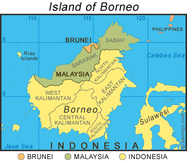
Map of Borneo: This map shows the countries and provinces / states that are located on the island of Borneo. It is the only island in the world that is shared by three different countries.
The Island of Borneo
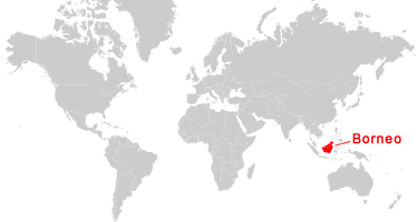
Borneo is the world's third-largest island and the largest island of Asia. It is part of the Indonesian archipelago. Borneo is surrounded by the Java Sea to its south, the Celebes Sea on its east, and the South China Sea to its north. It has an area of 288,869 square miles (748,168 square kilometers).
From neighboring islands, Borneo is north of Java, west of Sulawesi, and east of Sumatra. The island is bisected by the equator, with approximately half of its land area in the northern hemisphere and half in the southern hemisphere.
The island is divided between three countries: Indonesia (73%), Malaysia (26%), and Brunei (1%). The Indonesian provinces of North Kalimantan, South Kalimantan, East Kalimantan, West Kalimantan, and Central Kalimantan make up the southeastern part of the island. The Malaysian states of Sabah and Sarawak make up the northwestern part of the island. Brunei is a sovereign state located almost entirely on Borneo. It consists of two coastal tracts within the Malaysian state of Sarawak, and also includes several small adjacent islands.
The island of Borneo is rich in natural resources. Known metal deposits include: gold, silver, copper, tin, aluminum (as bauxite), and iron ore. Most of the island is covered by tropical forests that produce tropical timber and other forest products. The coastal and offshore areas are underlain by deposits of coal, peat, oil, and natural gas.
Where is Borneo?
Countries of Borneo:
Brunei, Indonesia, Malaysia
Regional Maps:
Map of Asia, World Map

Explore Borneo Using Google Earth:
Google Earth is a free program from Google that allows you to explore satellite images showing the cities and landscapes of Borneo and all of Asia in fantastic detail. It works on your desktop computer, tablet, or mobile phone. The images in many areas are detailed enough that you can see houses, vehicles and even people on a city street. Google Earth is free and easy-to-use.
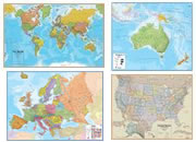
Borneo on a World Wall Map:
The island of Borneo is included on our Blue Ocean Laminated Map of the World. This map shows a combination of political and physical features. It includes country boundaries, major cities, major mountains in shaded relief, ocean depth in blue color gradient, along with many other features. This is a great map for students, schools, offices and anywhere that a nice map of the world is needed for education, display or decor.
Borneo On a Large Wall Map of Asia:
If you are interested in Borneo and the geography of Asia, our large laminated map of Asia might be just what you need. It is a large political map of Asia that also shows many of the continent's physical features in color or shaded relief. Major lakes, rivers, cities, roads, country boundaries, coastlines and surrounding islands are all shown on the map.
| More Maps |
 |
Gifts That Rock |
 |
Great Lakes |
 |
Map of the Oceans |
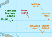 |
U.S. Territories |
 |
Types of Maps |
 |
Wall Maps |
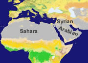 |
Map of the Ten Largest Deserts |
 |
What Is An Archipelago? |

Find Other Topics on Geology.com:

|

| ||

|

| ||

|

| ||

|

|