Home » World Maps » South America » Ecuador
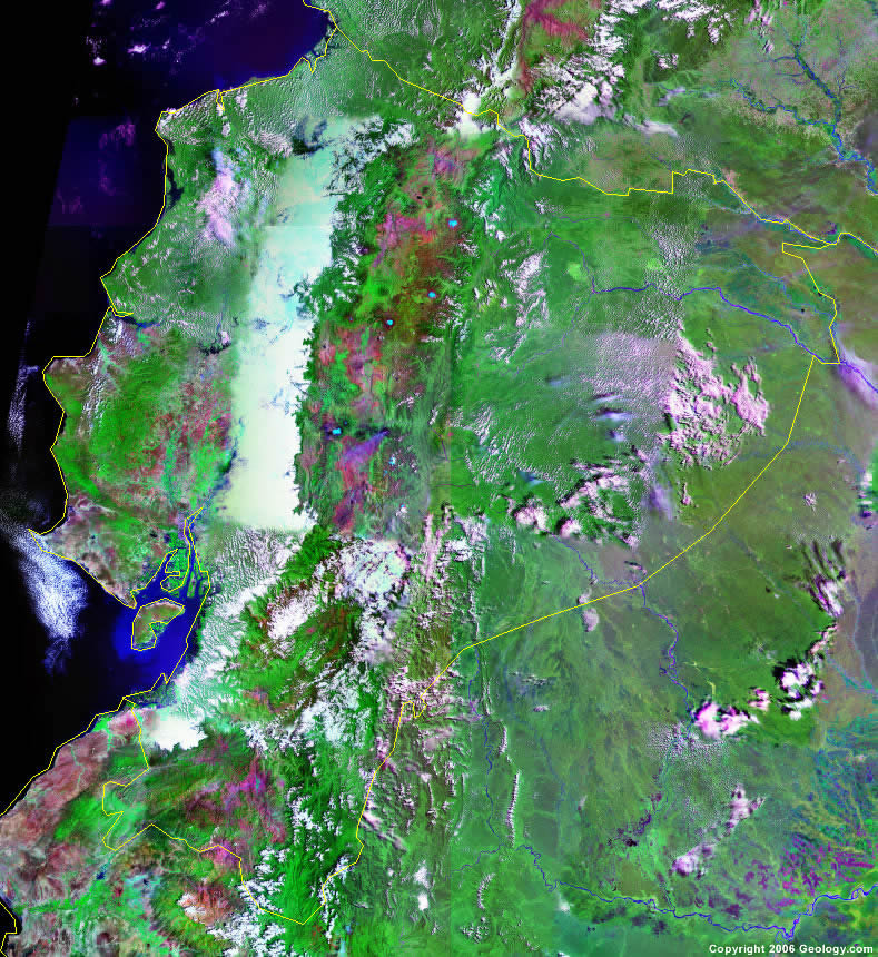
Ecuador Map and Satellite Image
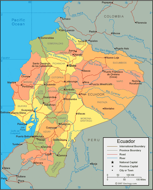
| Ecuador is located in western South America. It is bordered by the Pacific Ocean to the west, Colombia to the north, and Peru to the southeast. The Galapagos Islands, located in the Pacific Ocean, approximately 563 miles (906 km) off the west coast (and not shown on the map above), are a province of Ecuador. |
ADVERTISEMENT
Ecuador Bordering Countries:
Colombia, PeruRegional Maps:
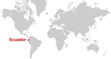
Galapagos Islands, South America, World MapWhere is Ecuador?
Ecuador Satellite Image
ADVERTISEMENT

Explore Ecuador Using Google Earth:
Google Earth is a free program from Google that allows you to explore satellite images showing the cities and landscapes of Ecuador and all of South America in fantastic detail. It works on your desktop computer, tablet, or mobile phone. The images in many areas are detailed enough that you can see houses, vehicles and even people on a city street. Google Earth is free and easy-to-use.
Ecuador on a World Wall Map:
Ecuador is one of nearly 200 countries illustrated on our Blue Ocean Laminated Map of the World. This map shows a combination of political and physical features. It includes country boundaries, major cities, major mountains in shaded relief, ocean depth in blue color gradient, along with many other features. This is a great map for students, schools, offices and anywhere that a nice map of the world is needed for education, display or decor.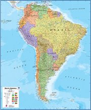
Ecuador On a Large Wall Map of South America:
If you are interested in Ecuador and the geography of South America our large laminated map of South America might be just what you need. It is a large political map of South America that also shows many of the continent's physical features in color or shaded relief. Major lakes, rivers,cities, roads, country boundaries, coastlines and surrounding islands are all shown on the map.Ecuador Cities:
Ambato, Azogues, Babahoyo, Baeza, Chone, Cuenca, Esmeraldas, Gualaquiza, Guaranda, Guayaquil, Ibana, Jipijapa, Latacunga, Loja, Macara, Macas, Machala, Manta, Milagre, Montalvo, Nueva Loja, Nuevo Rocafuerte, Otavalo, Pasaje, ortoviejo, Posorja, Puerto Bolivar, Puerto Misahualli, Puyo, Quevedo, Quito, iobamba, Salinas, San Lorenzo, Santa Elena, Santo Domingo de los Colorados, Tena, Tulcan and Zaruma.Ecuador Locations:
Aguarico River, Bahia de Ancon de Sardinas, Bahia de Manta, Bobonaza River, Boca de Conjimies, Cordillera de los Andes, Golfo de Guayaquil, Napo River, Pacific Ocean, Putumayo River, Rio Chira, Rio Coca, Rio Curaray, Rio Daule, Rio Esmeraldas, Rio Mira, Rio Napo, Rio Pastaze, Rio San Miguel, Rio Tigre, Rio Zemora and Santiago River.Ecuador Natural Resources:
Natural resources for Ecuador include petroleum, hydropower, timber and fish.Ecuador Natural Hazards:
Ecuador has natural hazards which include frequent earthquakes, landslides, and volcanic activity. Other occurrences in Ecuador are floods, or an occasional drought.Ecuador Environmental Issues:
Some of the environmental issues for Ecuador relate to land and water. There is water pollution, in addition to effluence from oil production wastes in the ecologically sensitive areas of the Amazon Basin and Galapagos Islands. The country also has deforestation, soil erosion and desertification.
ADVERTISEMENT