Home » World Maps » Asia » Israel
Israel Map and Satellite Image

| Israel is located in the Middle East. Israel is bordered by the Mediterranean Sea and the Gulf of Aqaba; Egypt and Gaza Strip to the west, Jordan, West Bank, and Syria to the east, and Lebanon to the north. |
ADVERTISEMENT
Israel Neighboring Countries:
Egypt, Gaza Strip, Jordan, Lebanon, Syria, West BankRegional Maps:
Asia, Middle East, World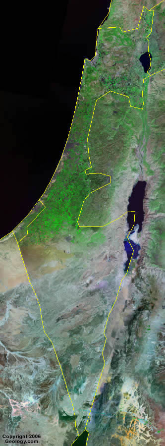
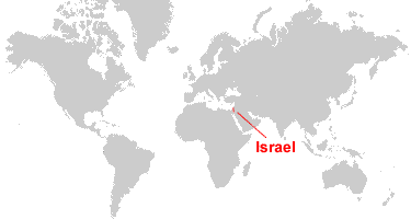
Where is Israel?

Explore Israel Using Google Earth:
Google Earth is a free program from Google that allows you to explore satellite images showing the cities and landscapes of Israel and all of Asia in fantastic detail. It works on your desktop computer, tablet, or mobile phone. The images in many areas are detailed enough that you can see houses, vehicles and even people on a city street. Google Earth is free and easy-to-use.
Israel on a World Wall Map:
Israel is one of nearly 200 countries illustrated on our Blue Ocean Laminated Map of the World. This map shows a combination of political and physical features. It includes country boundaries, major cities, major mountains in shaded relief, ocean depth in blue color gradient, along with many other features. This is a great map for students, schools, offices and anywhere that a nice map of the world is needed for education, display or decor.
Israel On a Large Wall Map of Asia:
If you are interested in Israel and the geography of Asia our large laminated map of Asia might be just what you need. It is a large political map of Asia that also shows many of the continent's physical features in color or shaded relief. Major lakes, rivers, cities, roads, country boundaries, coastlines and surrounding islands are all shown on the map.ADVERTISEMENT
Israel Cities:
Afula, Akko, Ashdod, Ashqelon, Bat Yam, Beersheba (Beer-Sheva), Bene Beraq, Beit She'an, Dimona, Elat, Hadera, Hefa (Haifa), Herzliyya, Holon, Jerusalem (Yerushalayim Al Quds), Mizpe Ramon, Nahariyya, Nazerat (Nazareth), Netanya, Oron, Petah Tiqwa, Ra'anana, Ramat Gan, Ramla, Rishon LeZiyyon, Tel Aviv-Yafo, Tiberias, Yotvata and Zefat.Israel Locations:
Biqat Uvda, Dead Sea, Gulf of Aqaba, Jordan River, Lake Tiberias, Mediterranean Sea and Sea of Galilee.Israel Natural Resources:
Israel has a variety of mineral resources such as potash, copper ore, phosphate rock, magnesium bromide and clays. Other resources for Israel are sand, natural gas and timber.Israel Natural Hazards:
Sandstorms may occur in Israel during the spring and summer. Other natural hazards for this country include droughts and periodic earthquakes.Israel Environmental Issues:
Israel has limited arable land and natural fresh water resources, which pose serious constraints for the country. Other environmental issues include: groundwater pollution from pesticides, chemical fertilizers, industrial and domestic waste; desertification; air pollution from vehicle and industrial emissions.
ADVERTISEMENT