Home » World Maps » Europe » Netherlands
Netherlands Map and Satellite Image

| The Netherlands are located in western Europe. The Netherlands are bordered by the North Sea, with Belgium to the south and Germany to the east. |
ADVERTISEMENT
Netherlands Bordering Countries:
Belgium, GermanyRegional Maps:
Map of Europe, World MapWhere are the Netherlands?

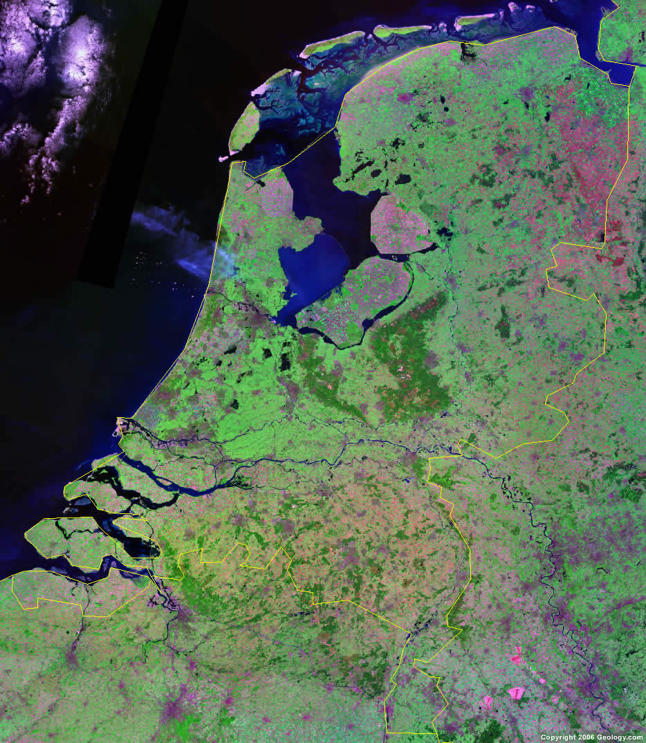
Netherlands Satellite Image
ADVERTISEMENT

Explore Netherlands Using Google Earth:
Google Earth is a free program from Google that allows you to explore satellite images showing the cities and landscapes of Netherlands and all of Europe in fantastic detail. It works on your desktop computer, tablet, or mobile phone. The images in many areas are detailed enough that you can see houses, vehicles and even people on a city street. Google Earth is free and easy-to-use.
Netherlands on a World Wall Map:
Netherlands is one of nearly 200 countries illustrated on our Blue Ocean Laminated Map of the World. This map shows a combination of political and physical features. It includes country boundaries, major cities, major mountains in shaded relief, ocean depth in blue color gradient, along with many other features. This is a great map for students, schools, offices and anywhere that a nice map of the world is needed for education, display or decor.
Netherlands On a Large Wall Map of Europe:
If you are interested in Netherlands and the geography of Europe our large laminated map of Europe might be just what you need. It is a large political map of Europe that also shows many of the continent's physical features in color or shaded relief. Major lakes, rivers,cities, roads, country boundaries, coastlines and surrounding islands are all shown on the map.Netherlands Cities:
Amsterdam, Appingedam, Assen, Borger, Delfzijl, Den Helder, Denekamp, Dordrecht, Eindhoven, Emmen, Enschede, Franeker, Gravenhage, Groningen, Haarlem, Hardenberg, Heerenveen, Hertogenbosch, Leeuwarden, Maastricht, Nijmegen, Odoorn, Rotterdam, Terneuzen, The Hague, Tilburg, Tubbergen, Utrecht, Vlagtwedde, Winschoten and Zwolle.Netherlands Locations:
Amerlander Gat, Amsterdam Rijnkanaal, Bergumermeer, Friesche Zeegat, Heegermeer, IJssel River, IJsselmeer, Ketelmeer, Lauwers, Lauwerszee, Maas River, Marsdiep, Nederrijn River, North Sea, Rhine River, Schildmeer, Sneekermeer, Tjeukemeer, Veluwemeer, Waal River, Waddenzee, Westereems and Zwartemeer.Netherlands Natural Resources:
Netherlands has fossil fuel deposits which include natural gas and petroleum. Other natural resources include peat, limestone, salt, arable land, sand and gravel.Netherlands Natural Hazards:
The Netherlands has natural hazards that occur, including flooding.Netherlands Environmental Issues:
The Netherlands has air pollution from vehicles and refining activities, and the resulting acid rain. There is water pollution from organic compounds, heavy metals, and nutrients such as nitrates and phosphates.
ADVERTISEMENT