Home » World Maps » Asia » China » Taiwan
Taiwan Map and Satellite Image
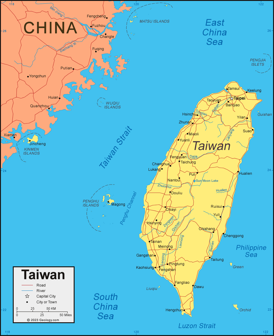
| Taiwan is located in southeastern Asia. Taiwan is a group of islands (the main island of Taiwan plus many smaller islands) bordered by the South China Sea, East China Sea, and the Philippine Sea. Taiwan is self-governing; however, according to the CIA World Factbook, which we use as a geographic reference, China considers Taiwan its 23rd province. |
ADVERTISEMENT
Taiwan Neighboring Countries:
None.Regional Maps:
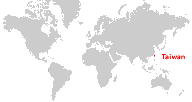
Map of China, Map of Japan, Map of the Philippines, Map of Asia, World MapWhere is Taiwan?
Taiwan Satellite Image

ADVERTISEMENT

Explore Taiwan Using Google Earth:
Google Earth is a free program from Google that allows you to explore satellite images showing the cities and landscapes of Taiwan and all of Asia in fantastic detail. It works on your desktop computer, tablet, or mobile phone. The images in many areas are detailed enough that you can see houses, vehicles and even people on a city street. Google Earth is free and easy-to-use.
Taiwan on a World Wall Map:
Taiwan is included on our Blue Ocean Laminated Map of the World. This map shows a combination of political and physical features. It includes country boundaries, major cities, major mountains in shaded relief, ocean depth in blue color gradient, along with many other features. This is a great map for students, schools, offices and anywhere that a nice map of the world is needed for education, display or decor.
Taiwan On a Large Wall Map of Asia:
If you are interested in Taiwan and the geography of Asia, our large laminated map of Asia might be just what you need. It is a large political map of Asia that also shows many of the continent's physical features in color or shaded relief. Major lakes, rivers, cities, roads, country boundaries, coastlines and surrounding islands are all shown on the map.Taiwan Cities:
Banqiao, Changhua, Chenggong, Chiayi, Chishang, Dawu, Douliu, Fangliao, Fengshan, Fengyuan, Gangshan, Hengchun, Hsinchu, Hsinying, Hualien, Jincheng, Kaohsiung, Keelung, Lukang, Magong, Meinong, Miaoli, Nantou, Pingtung, Puli, Ruisui, Suao, Taichung, Tainan, Taipei, Taitung, Tamsui, Taoyuan, Yilan, Yuanli, Yuli, Zhunan.Taiwan Islands and Island Groups:
Green Island, Guishan Island, Kinmen Islands, Liuqiu Island, Matsu Islands, Orchid Island and Little Orchid Island, Penghu Islands, Pengjia Islets, Wuqiu Islands.Taiwan Locations:
Bashi Channel, Beinan River, Chungyang Mountain Range, Dahan River, Dajia River, East China Sea, Gaoping River, Hualien River, Lanyang River, Laonong River, Luzon Strait, Penghu Channel, Philippine Sea, Qishan River, South China Sea, Sun Moon Lake, Taiwan Strait, Touqian River, Zengwen River, Zhuoshui River.Taiwan Natural Resources:
Taiwan has small fossil fuel deposits of coal and natural gas. Other natural resources include asbestos, limestone, and marble.Taiwan Natural Hazards:
Typhoons and earthquakes are two of the natural hazards that occur in Taiwan. Guishan Island (also known as Kueishantao Island or Turtle Mountain Island) is a historically active volcano; however, it has not erupted since 1853.Taiwan Environmental Issues:
Taiwan has a number of environmental issues. The island has a problem with its disposal of low-level radioactive waste. There is air pollution, and water pollution from raw sewage and industrial emissions. The drinking water supplies are contaminated. Taiwan also engages in the trade of endangered species.
ADVERTISEMENT