Home » World Maps » Africa » The Gambia
The Gambia Map and Satellite Image
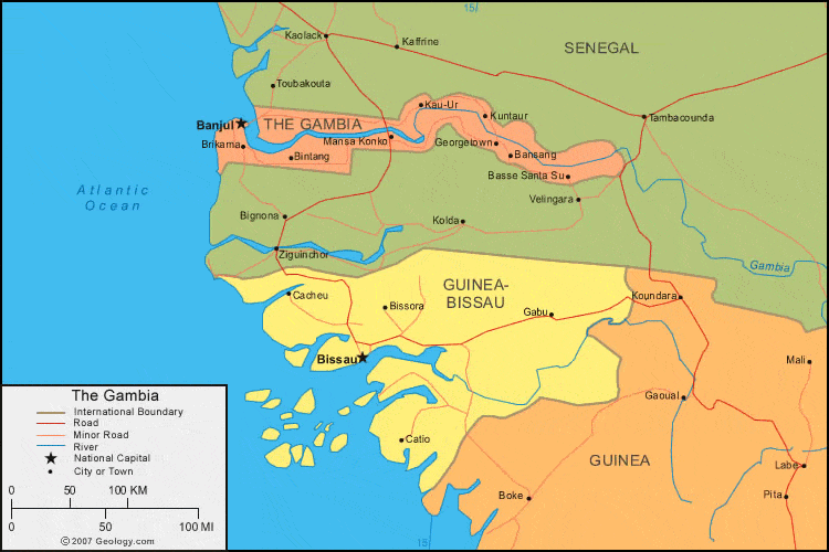
| The Gambia is located in western Africa. The Gambia is bordered by the Atlantic Ocean to the west, and Senegal to the north, east, and south. |
ADVERTISEMENT
The Gambia Bordering Countries:
SenegalRegional Maps:
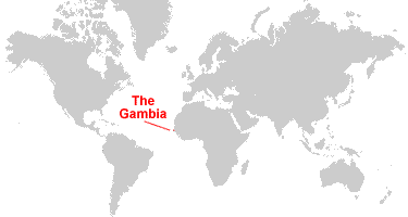
Map of Africa, World MapWhere is The Gambia?
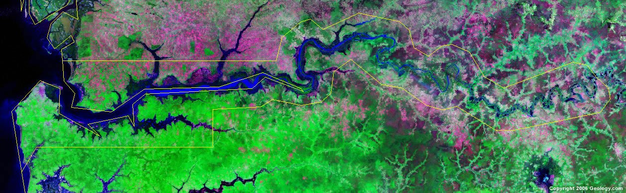
The Gambia Satellite Image
ADVERTISEMENT

Explore The Gambia Using Google Earth:
Google Earth is a free program from Google that allows you to explore satellite images showing the cities and landscapes of The Gambia and all of Africa in fantastic detail. It works on your desktop computer, tablet, or mobile phone. The images in many areas are detailed enough that you can see houses, vehicles and even people on a city street. Google Earth is free and easy-to-use.
The Gambia on a World Wall Map:
The Gambia is one of nearly 200 countries illustrated on our Blue Ocean Laminated Map of the World. This map shows a combination of political and physical features. It includes country boundaries, major cities, major mountains in shaded relief, ocean depth in blue color gradient, along with many other features. This is a great map for students, schools, offices and anywhere that a nice map of the world is needed for education, display or decor.
The Gambia On a Large Wall Map of Africa:
If you are interested in The Gambia and the geography of Africa our large laminated map of Africa might be just what you need. It is a large political map of Africa that also shows many of the continent's physical features in color or shaded relief. Major lakes, rivers, cities, roads, country boundaries, coastlines and surrounding islands are all shown on the map.The Gambia Cities:
Banjul, Bansang, Basse Santa Su, Bintang, Brikama, Georgetown, Kau-Ur, Konko, Kuntaur and Mansa Konko.The Gambia Locations:
Atlantic Ocean and Gambia River.The Gambia Natural Resources:
The Gambia has mineral resources which include tin, titanium (rutile and ilmenite), silica sand, clay and zircon. Recently the government has embarked on promoting the petroleum potential of The Gambia. Fish is also a natural resource for this country.The Gambia Natural Hazards:
A natural hazard for The Gambia is the increasing drought, as the country's rainfall amounts have dropped by 30% in the last 30 years.The Gambia Environmental Issues:
Some of the environmental issues for The Gambia, in western Africa, are deforestation and desertification. Water-borne diseases in this area are also prevalent.
ADVERTISEMENT