Home » World Maps » Asia » Vietnam
Vietnam Map and Satellite Image
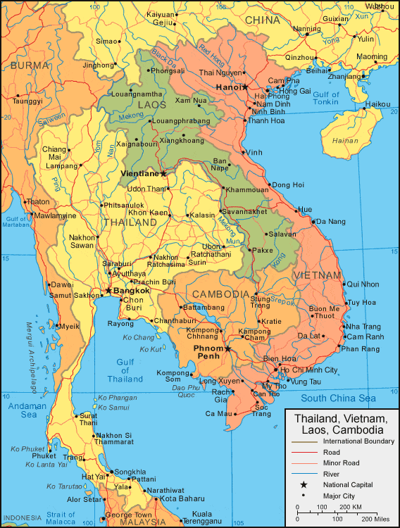
| Vietnam is located southeastern Asia. Vietnam is bordered by the South China Sea and Gulf of Tonkin to the east, China to the north, and Laos and Cambodia to the west. |
ADVERTISEMENT
Vietnam Bordering Countries:
Cambodia, China, LaosRegional Maps:
Map of Asia, World Map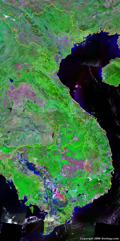
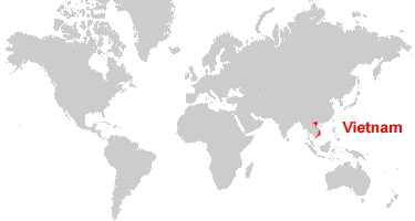
Where is Vietnam?

Explore Vietnam Using Google Earth:
Google Earth is a free program from Google that allows you to explore satellite images showing the cities and landscapes of Vietnam and all of Asia in fantastic detail. It works on your desktop computer, tablet, or mobile phone. The images in many areas are detailed enough that you can see houses, vehicles and even people on a city street. Google Earth is free and easy-to-use.
Vietnam on a World Wall Map:
Vietnam is one of nearly 200 countries illustrated on our Blue Ocean Laminated Map of the World. This map shows a combination of political and physical features. It includes country boundaries, major cities, major mountains in shaded relief, ocean depth in blue color gradient, along with many other features. This is a great map for students, schools, offices and anywhere that a nice map of the world is needed for education, display or decor.
Vietnam On a Large Wall Map of Asia:
If you are interested in Vietnam and the geography of Asia our large laminated map of Asia might be just what you need. It is a large political map of Asia that also shows many of the continent's physical features in color or shaded relief. Major lakes, rivers, cities, roads, country boundaries, coastlines and surrounding islands are all shown on the map.ADVERTISEMENT
Vietnam Cities:
Bac Lieu, Bien Hoa, Binh, Buon Me Thout, Ca Mau, Cam Pha, Cam Ranh, Can Tho, Da Lat, Da Nang, Dong Hoi, Gia Dinh, Ha Tinh, Hai Phong, Haiphong, Hanoi, Ho Chi Minh City, Hong Gai, Hue, Long Xuyen, My Tho, Nam Dinh, Nha Trang, Ninh Binh, Phan Rang, Qui Nhon, Rach Gia, Soc Trang, Thai Nguyen, Thanh Hoa, Tuy Hoa, Vinh and Vung Tau.Vietnam Locations:
Annam Cordillera Mountains, Co Chien River, Cua Song Bay Hap, Da (Black River), Dam Nuoc Ngot, Fan Si Pan Mountain, Gulf of Thailand, Gulf of Tonkin, Hau Giang River, Ho Lac Thien, Hong (Red River), South China Sea, Tien Giang (Mekong River), Vung Cam Ranh, Vung Da Nang, Vung Rach Gia, Vung Van Phong and Vung Xuan Dai.Vietnam Natural Resources:
Vietnam has several fuel resources, some of which are coal, offshore deposits of oil and gas, and hydropower. Various other natural resources include phosphates, chromate, manganese, bauxite and forests.Vietnam Natural Hazards:
From May to January, Vietnam does experience occasional typhoons. They often produce extensive flooding, especially in the Mekong River delta.Vietnam Environmental Issues:
Vietnam has a number of environmental issues. These include deforestation and soil degradation, which is complicated by slash-and-burn agricultural and logging practices. The environments of Hanoi and Ho Chi Minh City are rapidly degrading from population migration and the growing urban industrialization. Water issues for Vietnam include overfishing, which threaten marine life populations; groundwater contamination, which limits the supply of potable water; and water pollution.
ADVERTISEMENT