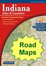
Home » US Maps » Indiana » Roads and Cities
Map of Indiana Cities and Roads

ADVERTISEMENT
City Maps for Neighboring States:
Illinois Kentucky Michigan Ohio


Indiana Cities:
Cities with populations over 10,000 include: Anderson, Auburn, Bedford, Bloomington, Brownsburg, Carmel, Clarksville, Columbus, Connersville, Crawfordsville, Crown Point, East Chicago ,Elkhart, Evansville, Fishers, Fort Wayne, Frankfort, Franklin, Gary, Goshen, Greenfield, Greensburg, Greenwood, Griffith, Hammond, Hobart, Huntington, Indianapolis, Jasper, Jeffersonville, Kokomo, La Porte, Lafayette, Lawrence, Lebanon, Logansport, Madison, Marion, Martinsville, Merrillville, Michigan City, Mishawaka, Muncie, New Albany, New Castle, New Haven, Noblesville, Peru, Plainfield, Plymouth, Portage, Richmond, Seymour, Shelbyville, South Bend, Terre Haute, Valparaiso, Vincennes, Wabash, Warsaw, Washington and West Lafayette.
Indiana Interstates:
North-South interstates include: Interstate 65 and Interstate 69. East-West interstates include: Interstate 64, Interstate 70, Interstate 74, Interstate 80, Interstate 90 and Interstate 94.
Indiana Routes:
US Highways and State Routes include: Route 6, Route 20, Route 24, Route 27, Route 30, Route 31, Route 33, Route 35, Route 36, Route 40, Route 41, Route 50, Route 52, Route 136, Route 150, Route 224, Route 231 and Route 421.
ADVERTISEMENT

