Home » US Maps » Kansas » Lakes and Rivers
Kansas Lakes, Rivers and Water Resources
ADVERTISEMENT
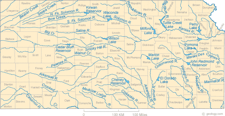
Kansas Rivers Shown on the Map: Arkansas River, Beaver Creek, Big Blue River, Big Creek, Bow Creek, Chikaskia River, Cimarron River, Cottonwood River, Crooked Creek, Kansas River, Marais Des Cygnes River, Marmaton River, Medicine Lodge River, Neosho River, North Fork Solomon River, Pawnee River, Republican River, Saline River, Sappa Creek, Smoky Hill River, Solomon River, South Fork Solomon River, Verdigris River, Walnut Creek and Walnut River.
Kansas Lakes Shown on the Map: Cedar Bluff Reservoir, Cheney Reservoir, El Dorado Lake, John Redmond Reservoir, Kirwan Reservoir, Marion Lake, Milford Lake, Perry Lake, Pomona Lake, Tuttle Creek Lake, Waconda Lake and Wilson Lake.
| Kansas Stream and River Levels |
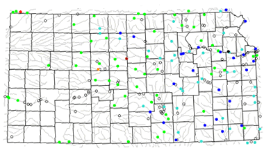 The United States Geological Survey has a number of stream gages located throughout Kansas. These estimate stream levels, discharges and record them over time. This data is published on the web and many stations allow users to plot custom graphs. Get updated Kansas river and stream levels from USGS here.
| Kansas Stream and River Level Alerts |
 The United States Geological Survey has a system that will send you an email message when flood levels are reached on any stream with USGS gaging equipment that you have selected. Sign up here to receive Kansas stream and river level alerts.

| Kansas Drought Map |
 The United States Geological Survey publishes updated drought maps on their website. There you can view a map that shows where below normal 7-day average stream flow conditions were recently recorded. The maps are updated daily. Get a current Kansas drought map here.
| Kansas Water Publications |
 The United States Geological Survey has a number of publications related to water use and water resources in Kansas. Visit the Kansas Water Science Center here.
| Kansas Elevation Map |
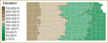 The topography of an area determines the direction of stream flow and often is a primary influence on the geographic distribution of precipitation. View a detailed Kansas elevation map.


Find Other Topics on Geology.com:

|

| ||

|

| ||

|

| ||

|

|