Home » Earthquakes » Earthquakes in the Central Virginia Seismic Zone
Earthquakes in the Central Virginia Seismic Zone
Central Virginia Experiences an Earthquake Every Year or Two
Modified after a summary by the USGS Earthquake Hazards Program
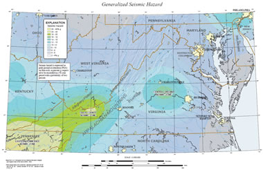
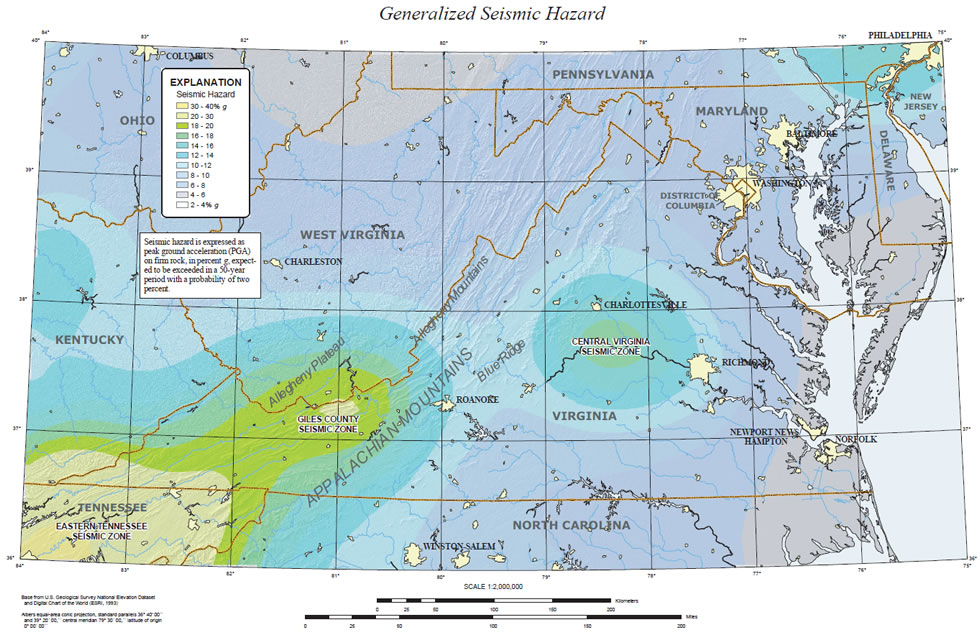
Virginia seismic zones: Two distinct seismic zones are located in Virginia: The Central Virginia Seismic Zone and the Giles County Seismic Zone. Both of these zones produce recurrent small earthquakes at least every few years. Map by USGS. Click to enlarge.
Background
Since at least 1774, people in central Virginia have felt small earthquakes and suffered damage from infrequent
larger ones. The largest damaging earthquake (magnitude 5.9 with a Modified Mercalli Intensity of VII) occurred on August 23, 2011. The second largest
damaging earthquake (magnitude 4.8) in the seismic zone occurred in 1875. Smaller earthquakes that cause little or no damage are felt each year or two.
Huge "Felt Areas" of Eastern Earthquakes
Earthquakes in the central and eastern U.S., although less frequent than in
the western U.S., are typically felt over a much broader region. East of the
Rockies, an earthquake can be felt over an area as much as ten times larger than a similar magnitude earthquake on the west coast. A magnitude 4.0
eastern U.S. earthquake typically can be felt at many places as far as 100 km (60 mi) from where it occurred, and it infrequently causes damage near
its source. A magnitude 5.5 eastern U.S. earthquake usually can be felt as far as 500 km (300 mi) from where it occurred, and sometimes causes damage
as far away as 40 km (25 mi).
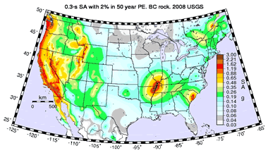
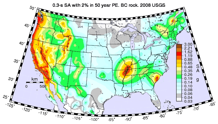
US earthquake map: Although occasional earthquakes occur in the Central Virginia Seismic Zone and the Giles County Seismic Zone, the earthquake hazard in these areas is much lower than in other parts of the United States. Map by USGS. Click to enlarge.
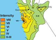
"Felt Area" of the August 23, 2011 Earthquake
A compilation of news reports from various sources indicates that the August 23, 2011 earthquake was felt in at least 22 states (New Jersey, New York,
Pennsylvania, Delaware, Maryland, Virginia, West Virginia, North Carolina, South Carolina, Tennessee, Kentucky, Ohio, Massachusetts, Rhode Island, Connecticut,
Vermont, New Hampshire, Maine, Indiana, Georgia, Florida) plus The District of Colombia.
Virginia Bedrock History
Earthquakes everywhere occur on faults within bedrock, usually miles deep. Most bedrock beneath central Virginia was assembled as continents collided to form a supercontinent about 500-300 million years ago, raising the Appalachian Mountains. Most of the rest of the bedrock formed when the supercontinent rifted apart about 200 million years ago to form what are now the northeastern U.S., the Atlantic Ocean, and Europe.
Virginia Earthquakes Occur on Subsurface Faults
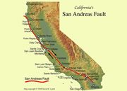
At well-studied plate boundaries like the San Andreas fault system in
California, often scientists can determine the name of the specific fault that is responsible for an earthquake. In contrast, east of the Rocky
Mountains this is rarely the case. The Central Virginia Seismic Zone is far from the nearest plate boundaries, which are in the center of the Atlantic
Ocean and in the Caribbean Sea. The seismic zone is laced with known faults but numerous smaller or deeply buried faults remain undetected. Even the
known faults are poorly located at earthquake depths. Accordingly, few, if any, earthquakes in the seismic zone can be linked to named faults. It is
difficult to determine if a known fault is still active and could slip and cause an earthquake. As in most other areas east of the Rockies, the best
guide to earthquake hazards in the seismic zone is the earthquakes themselves.

Find Other Topics on Geology.com:
 | Rocks: Galleries of igneous, sedimentary and metamorphic rock photos with descriptions. |
|
 | Minerals: Information about ore minerals, gem materials and rock-forming minerals. |
|
 | Volcanoes: Articles about volcanoes, volcanic hazards and eruptions past and present. |
|
 | Gemstones: Colorful images and articles about diamonds and colored stones. |
|
 | General Geology: Articles about geysers, maars, deltas, rifts, salt domes, water, and much more! |
|
 | Geology Store: Hammers, field bags, hand lenses, maps, books, hardness picks, gold pans. |
|

|
 | Diamonds: Learn about the properties of diamond, its many uses, and diamond discoveries.
|
|