Home » World Maps » Africa » Botswana
Botswana Map and Satellite Image

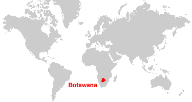
| Botswana is located in southern Africa. Botswana is bordered by Namibia to the north and west, Zimbabwe to the east, and South Africa to the south. |
ADVERTISEMENT
Botswana Bordering Countries:
Namibia, South Africa, ZimbabweRegional Maps:
Map of Africa, World MapWhere is Botswana?
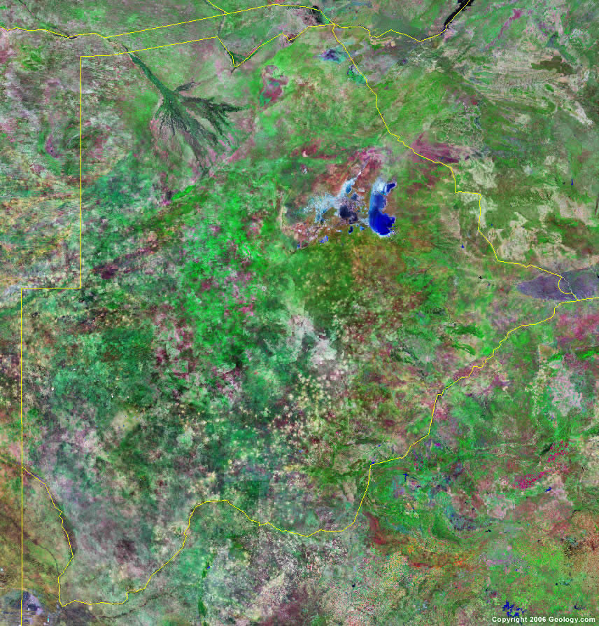
Botswana Satellite Image
ADVERTISEMENT

Explore Botswana Using Google Earth:
Google Earth is a free program from Google that allows you to explore satellite images showing the cities and landscapes of Botswana and all of Africa in fantastic detail. It works on your desktop computer, tablet, or mobile phone. The images in many areas are detailed enough that you can see houses, vehicles and even people on a city street. Google Earth is free and easy-to-use.
Botswana on a World Wall Map:
Botswana is one of nearly 200 countries illustrated on our Blue Ocean Laminated Map of the World. This map shows a combination of political and physical features. It includes country boundaries, major cities, major mountains in shaded relief, ocean depth in blue color gradient, along with many other features. This is a great map for students, schools, offices and anywhere that a nice map of the world is needed for education, display or decor.
Botswana On a Large Wall Map of Africa:
If you are interested in Botswana and the geography of Africa our large laminated map of Africa might be just what you need. It is a large political map of Africa that also shows many of the continent's physical features in color or shaded relief. Major lakes, rivers, cities, roads, country boundaries, coastlines and surrounding islands are all shown on the map.Botswana Cities:
Bogogobo, Dutlwe, Francistown, Gaborone, Ghanzi, Gweta, Hukuntsi, Jwaneng, Kang, Kasane, Kayne, Khudumelapye, Khuis, Lobatse, Mahalapye, Makalamabedi, Mamuno, Maun, Mochudi, Molepolole, Mosetse, Muhembo, Nata, Orapa, Palapye, Rakops, Ramotswa, Sebina, Selebi Phikwe, Serowe, Shadawe, Shorobe, Toteng, Tsau, Tshabong, Tshane, Tshootsha and Werda.Botswana Locations:
Chobe River, Cuando River, Kalahari Desert, Lake Ngami, Lake Xau, Limpopo River, Linyanti River, Makgadikgadi Pans (Makarikari), Molopo River, Okavango Delta and Okavango River.Botswana Natural Resources:
Botswana's mineral resources include silver, diamonds, gemstones, iron ore, copper, nickel, salt, soda ash, potash and coal.Botswana Natural Hazards:
Botswana has natural hazards which include the periodic drought. In addition, seasonal August winds blow from the west, carrying sand and dust across the country, obscuring visibility.Botswana Environmental Issues:
The environmental issues for Botswana, in southern Africa, include limited fresh water resources, overgrazing, and desertification.
ADVERTISEMENT