Home » World Maps » CIA Map of Europe
CIA Map of Europe
Political and physical maps of Europe prepared by the Central Intelligence Agency of the United States.

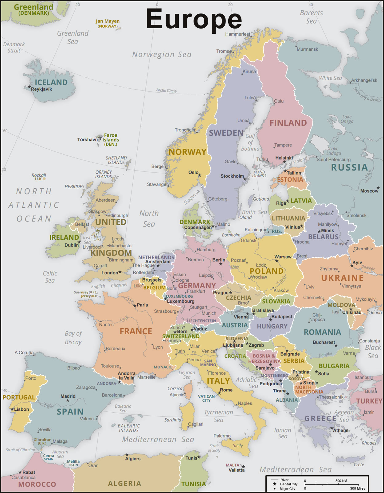
| The political map of Europe shown above was prepared by the United States Central Intelligence Agency, better known as the CIA, in Januray 2015. The CIA creates maps intended for use by officials of the United States government and for the general public. The CIA's maps present the geographic names and geographic boundaries recognized by the United States government.
In our dynamic world, country names, country divisions, country boundaries, names used for bodies of water, and other geographic information can change. For that reason, the CIA updates their maps periodically and redistributes them to government officials and the general public. The map was produced using a Robinson projection with standard parallels at 38 degrees north and 38 degrees south. Boundary representation is not necessarily authoritative. |
ADVERTISEMENT
| The political map of Europe shown above was prepared by the CIA in October 2019. The map was produced using a Lambert conformal conic projection, with standard parallels at 40 degrees north and 68 degrees north. Boundary representation is not necessarily authoritative. |
Where is Europe?


| The physical map of Europe shown above was prepared by the United States Central Intelligence Agency, better known as the CIA, in November 2019. The CIA creates maps intended for use by officials of the United States government and for the general public.
Europe has a diversity of terrains, physical features, and climates. This map shows the physical features of Europe, surrounding lands, and offshore areas. Topography and bathymetry are shown in a combination of color with shaded relief. The map was produced using a Lambert conformal conic projection, with standard parallels at 40 degrees north and 68 degrees north. Boundary representation is not necessarily authoritative. |
Physical Map of Europe:
Check out the terrain of the continent with this physical map of Europe. At a glance, you can see many mountain ranges; for example, the Pyrenees, the Alps, the Carpathian Mountains, and the Scandinavian Mountains. The Ural Mountains in Russia, along with the Caucasus Mountains between Russia and Georgia/Azerbaijan, are two mountain ranges which serve as physical landmarks showing approximately where eastern Europe meets western Asia.
Explore Europe Using Google Earth:
Google Earth is a free program from Google that allows you to explore satellite images showing the cities and landscapes of Europe and the rest of the world in fantastic detail. It works on your desktop computer, tablet, or mobile phone. The images in many areas are detailed enough that you can see houses, vehicles and even people on a city street. Google Earth is free and easy-to-use.
Europe on a World Wall Map:
Europe is one of 7 continents illustrated on our Blue Ocean Laminated Map of the World. This map shows a combination of political and physical features. It includes country boundaries, major cities, major mountains in shaded relief, ocean depth in blue color gradient, along with many other features. This is a great map for students, schools, offices and anywhere that a nice map of the world is needed for education, display or decor.
Large Wall Map of Europe:
If you are interested in the geography of Europe, our large laminated map of Europe might be just what you need. It is a large political map of Europe that also shows many of the continent's physical features in color or shaded relief. Major lakes, rivers, cities, roads, country boundaries, coastlines and surrounding islands are all shown on the map.
ADVERTISEMENT