Home » World Maps » Asia » India
India Map and Satellite Image
India Map of Cities, Roads, and Rivers

| India is located in southern Asia. It is bordered by the Arabian Sea, Laccadive Sea, and the Bay of Bengal to the south; Bhutan, Nepal, China, and Pakistan to the north; and Bangladesh and Myanmar (Burma) to the east.
Note: The political maps on this page show boundary lines and the 1972 Line of Control as depicted on maps published by the CIA World Factbook, which we used as our primary reference for political boundaries as recognized by the United States. [Source Map] |
ADVERTISEMENT
India States and Union Territories Map

| Note: The political maps on this page show boundary lines and the 1972 Line of Control as depicted on maps published by the CIA World Factbook, which we used as our primary reference for political boundaries as recognized by the United States. [Source Map] |
India Bordering Countries:
Bangladesh, Bhutan, China, Myanmar (Burma), Nepal, PakistanRegional Maps:
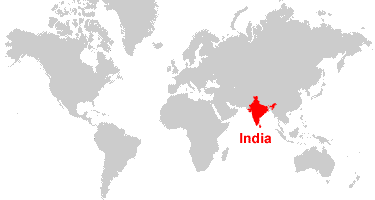
Map of Asia, World MapWhere is India?
India Satellite Image

ADVERTISEMENT

Explore India Using Google Earth:
Google Earth is a free program from Google that allows you to explore satellite images showing the cities and landscapes of India and all of Asia in fantastic detail. It works on your desktop computer, tablet, or mobile phone. The images in many areas are detailed enough that you can see houses, vehicles and even people on a city street. Google Earth is free and easy-to-use.
India on a World Wall Map:
India is one of nearly 200 countries illustrated on our Blue Ocean Laminated Map of the World. This map shows a combination of political and physical features. It includes country boundaries, major cities, major mountains in shaded relief, ocean depth in blue color gradient, along with many other features. This is a great map for students, schools, offices and anywhere that a nice map of the world is needed for education, display or decor.
India On a Large Wall Map of Asia:
If you are interested in India and the geography of Asia our large laminated map of Asia might be just what you need. It is a large political map of Asia that also shows many of the continent's physical features in color or shaded relief. Major lakes, rivers, cities, roads, country boundaries, coastlines and surrounding islands are all shown on the map.India Cities:
Agartala, Agra, Ahmedabad, Aizawl, Allahabad, Amritsar, Balasore, Bengaluru, Bareilly, Bhopal, Bhubaneswar, Bhuj, Bikaner, Chandigarh, Chennai (Madras), Coimbatore, Cuddalore, Cuttack, Daman, Dehradun, Dibrugarh, Dispur, Diu, Gandhinagar, Gangtok, Gorakhpur, Guntakal, Gwalior, Haldia, Hyderabad, Imphal, Indore, Itanagar, Jabalpur, Jaipur, Jaisalmer, Jammu, Jamnagar, Jamshedpur, Jhansi, Jodhpur, Kakinada, Kanpur, Kargil, Kavaratti, Kochi (Cochin), Kohima, Kolkata (Calcutta), Kota, Kozhikode, Leh, Lucknow, Ludhiana, Madurai, Mangaluru, Mumbai (Bombay), Nagpur, Nagpur, New Delhi, Panaji, Paradip, Pathankot, Patna, Porbandar, Port Blair, Puducherry, Pune, Raipur, Rajkot, Ranchi, Shillong, Silchar, Silvassa, Shimla, Solapur, Srinagar, Surat, Thiruvananthapuram, Thoothukudi, Tinsukia, Udaipur, Vadodara, Varanasi (Benares), Vasco da Gama, Vijayawada, and Visakhapatnam.India States:
Andhra Pradesh, Arunachal Pradesh, Assam, Bihar, Chhattisgarh, Goa, Gujarat, Haryana, Himachal Pradesh, Jammu and Kashmir, Jharkhand, Karnataka, Kerala, Madhya Pradesh, Maharashtra, Manipur, Meghalaya, Mizoram, Nagaland, Odisha, Punjab, Rajasthan, Sikkim, Tamil Nadu, Telangana, Tripura, Uttar Pradesh, Uttarakhand, and West Bengal.India Union Territories:
Andaman and Nicobar Islands, Chandigarh, Dadra and Nagar Haveli, Daman and Diu, Delhi, Lakshadweep, and Puducherry.India Locations:
Andaman Islands, Andaman Sea, Arabian Sea, Aravalli Range, Bay of Bengal, Bhima River, Chambal River, Chenab River, Chilka Lake, Dhebar Lake, Ganga (Ganges) River, Ghaghara River, Godavari River, Great Indian Desert (Thar Desert), Gulf of Khambhat, Gulf of Kutch, Gulf of Mannar, Himalayas, Kaveri River, Krishna River, Laccadive Sea, Lakshadweep Islands, Mahanadi River, Mouths of the Ganges, Narmada River, Nicobar Islands, Nizam Sagar, Palk Bay, Palk Strait, Pulicat Lake, Rann of Kutch, Rihand River, Son River, and Yamuna River.India Natural Resources:
India has the fourth-largest reserve of coal in the world. Other fuel-related resources are natural gas and petroleum. There are a number of metallic resources which include chromite, bauxite, iron ore, titanium ore, manganese, and mica. Other natural resources include diamonds, limestone and arable land.India Natural Hazards:
India has a number of natural hazards, which include droughts, severe thunderstorms, flash floods, and earthquakes, as well as widespread and destructive flooding from monsoonal rains.India Environmental Issues:
Environmental issues for India are numerous. These include deforestation, soil erosion, overgrazing, and desertification. The country has a huge and growing population which is overstraining natural resources. Tap water is not potable throughout the country, and there is water pollution from the runoff of agricultural pesticides and raw sewage. In addition, India has air pollution from industrial effluents and vehicle emissions.
ADVERTISEMENT