Home » World Maps » Europe » Ireland
Ireland Map and Satellite Image

| Ireland is located in western Europe. The island of Ireland is bordered by the Atlantic Ocean, the Irish Sea, and the Celtic Sea. The country of Ireland is bordered to the north by Northern Ireland. |
ADVERTISEMENT
Ireland Bordering Countries:
United Kingdom (Northern Ireland)Regional Maps:
Map of Europe, World Map| Related Article: United Kingdom, Great Britain, British Isles - What's the Difference? |
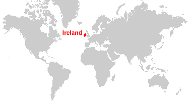
Where is Ireland?
Ireland Satellite Image

ADVERTISEMENT

Explore Ireland Using Google Earth:
Google Earth is a free program from Google that allows you to explore satellite images showing the cities and landscapes of Ireland and all of Europe in fantastic detail. It works on your desktop computer, tablet, or mobile phone. The images in many areas are detailed enough that you can see houses, vehicles and even people on a city street. Google Earth is free and easy-to-use.
Ireland on a World Wall Map:
Ireland is one of nearly 200 countries illustrated on our Blue Ocean Laminated Map of the World. This map shows a combination of political and physical features. It includes country boundaries, major cities, major mountains in shaded relief, ocean depth in blue color gradient, along with many other features. This is a great map for students, schools, offices and anywhere that a nice map of the world is needed for education, display or decor.
Ireland On a Large Wall Map of Europe:
If you are interested in Ireland and the geography of Europe our large laminated map of Europe might be just what you need. It is a large political map of Europe that also shows many of the continent's physical features in color or shaded relief. Major lakes, rivers, cities, roads, country boundaries, coastlines and surrounding islands are all shown on the map.Ireland Cities:
Ardara, Arklow, Athlone, Ballina, Ballyduff, Ballyshannon, Bangor Erris, Bantry, Bray, Cahef, Carlow, Carrick on Shannon, Castlebar, Cavan, Charlestown, Claremorris, Clifden, Clonmel, Cork (Corcaigh), Creeslough, Donegal, Drogheda, Dublin (Baile Atha Cliath), Dundalk (Dun Dealgan), Durrow, Ennis, Ennistimon, Fermoy, Foynes, Galway (Gaillimh), Glencolumbkille, Kenmare, Kilkee, Kilkenny, Killarney, Letterkenny, Lifford, Limerick (Luimneach), Longford, Macroom, Malin More, Mallow, Monaghan, Mullingar, Naas, Nenagh, New Ross, Port Laoise, Roscommon, Roscrea, Rosslarre, Shannon, Sligo, Tallow, Tipperary, Tralee (Traighli), Trim, Tuam, Tullamore, Waterford (Port Lairge), Westport, Wexford and Wicklow.Ireland Locations:
Atlantic Ocean, Blue Stack Mountains, Celtic Sea, Dingle Bay, Donegal Bay, Dundalk Bay, Galty Mountains, Galway Bay, Inishtrahull Sound, Irish Sea, Knockmealdown Mountains, Lough Conn, Lough Corrib, Lough Derravaragh, Lough Ennell, Lough Leane, Lough Mask, Lough Owel, Lough Ree, Lough Sheelin, North Channel, River Shannon, Slieve Bloom Mountains, Slieve Gamph (The Ox Mountains), St. George's Channel, Waterford Harbour, Wexford Harbour and Wicklow Mountains.Ireland Natural Resources:
Fuel resources in Ireland include natural gas and peat. Copper, lead, silver and zinc are some of the metal resources for this country. The mineral resources include barite, dolomite, gypsum and limestone.Ireland Natural Hazards:
Rarely, Ireland can experience extreme weather events.Ireland Environmental Issues:
An environmental issue for Ireland is water pollution from agricultural runoff, especially in the country's lakes. Another problem is acid rain, which kills plants and ruins the fertility of the soil, contributing to deforestation.
ADVERTISEMENT