Home » World Maps » Europe » The British Isles
United Kingdom, Great Britain, British Isles
What's the Difference?
A Primer in Terminology
Many people are confused about the different names used to refer to the islands and countries located northwest of Europe in the North Atlantic Ocean. We have made a few simple maps to help clarify.

Great Britain:
Geographically refers to the large island that is shared by the countries of England, Scotland, and Wales.
In a political sense, Great Britain also includes the smaller surrounding islands, such as the Hebrides, the Orkney Islands, the Shetland Islands, and others.
Great Britain does not include any part of Ireland. Great Britain does not include the Isle of Man or the Channel Islands.
Variations of the name "Britain" have been used since at least the first century AD. In the times of the Roman Empire, the area called Provincia Britannia was populated by people called Britons. Britannia included England and Wales, but for the most part did not include Scotland. Hadrian's Wall, which was essentially the northern border of Britannia, was built in the current-day counties of Cumbria and Northumberland in England. [1] Centuries later, with the Acts of Union 1707, "Great Britain" became the official name for the entire island.
Ireland:
Ireland is the name of the entire island that is shared by the countries of Northern Ireland and the Republic of Ireland.
When people refer to "Ireland," this can mean the entire island OR just the Republic of Ireland. When people are referring to Northern Ireland, they often specify "Northern Ireland."
Why is the island divided? The short, simplistic answer is that the people have differing views on religion and politics.
Toward the end of the 19th century, longstanding religious and political differences caused the creation of two groups: the Nationalists and the Unionists. The Nationalists, who were mostly Catholic, were in favor of Irish self-government. The Unionists, who were mostly Protestant, were in favor of union with Britain.
The Nationalists wanted total independence from Britain, and this led to the Irish War of Independence from 1919-1921. Following the Fourth Government of Ireland Act 1920, the island was partitioned into "Northern Ireland" and "Southern Ireland."
The Anglo-Irish Treaty was signed in 1921, which put an end to the war and created a new and self-governing "Irish Free State" in 1922. Northern Ireland, which was home to many Protestant Unionists, immediately opted out of the Free State to stay with Great Britain. The remaining southern portion of the Irish Free State, home to many Catholic Nationalists, later became known as the Republic of Ireland. [2]
This is why today we have the Republic of Ireland as a separate sovereign country, while Northern Ireland is part of the United Kingdom of Great Britain and Northern Ireland.
United Kingdom:
Official name: "United Kingdom of Great Britain and Northern Ireland." Includes Great Britain and Northern Ireland.
The United Kingdom is a sovereign state made up of 4 countries (England, Scotland, Wales, and Northern Ireland). Interestingly, the U.K. itself can also be called a "country." However, its constituent countries are not sovereign and therefore cannot be called "sovereign states."
London is the capital of both the country of England and the sovereign state of the United Kingdom.
Some people use the names "Great Britain" and "United Kingdom" interchangeably, but this is incorrect. As discussed in this article, the United Kingdom includes Northern Ireland, whereas Great Britain does not include any part of Ireland.
The United Kingdom was a member of the European Union (EU) from 1973 to 2020.
British Isles:
A geographic term for all islands in the archipelago. Includes the islands of Great Britain, the islands of Ireland, and the Isle of Man. The Channel Islands can also be considered part of the British Isles even though they are not geographically part of the archipelago. [3]
While the term "British Isles" is frequently used to refer to this collection of islands, some feel that the name has political implications and prefer alternatives such as "Britain and Ireland," "British and Irish Isles," "British-Irish Isles," or "IONA (Islands of the North Atlantic)."
However, these alternative names are not without their own problems. "IONA (Islands of the North Atlantic)" seems too vague, as there are other islands in the North Atlantic Ocean (Iceland, Faroe Islands, etc.) that are not part of the British Isles. Additionally, "Iona" is the name of an island in the Hebrides of Scotland, which could lead to even more confusion.
"Britain and Ireland" is too limited, as it excludes the Isle of Man and Channel Islands.
So perhaps the best alternative would be "British-Irish Isles" because it is the most concise name without being too vague or too limited.
Crown Dependencies:
The Isle of Man and the Channel Islands (the Bailiwick of Guernsey and the Bailiwick of Jersey) are Crown Dependencies. They are self-governing and are not part of Great Britain or the United Kingdom. However, the islands do depend on the UK for matters of defense and external affairs.
| References |
|
[1] 30 Surprising Facts About Hadrian's Wall: Article on the English Heritage website, last accessed October 2022.
[2] Ireland: Article on the New World Encyclopedia website, last accessed October 2022. [3] Oxford English Dictionary: "British Isles: a geographical term for the islands comprising Great Britain and Ireland with all their offshore islands including the Isle of Man and the Channel Islands." |
British Overseas Territories:
There are 14 British Overseas Territories: Akrotiri and Dhekelia; Anguilla; Bermuda; British Antarctic Territory; British Indian Ocean Territory; British Virgin Islands; Cayman Islands; Falkland Islands; Gibraltar; Montserrat; Pitcairn, Henderson, Ducie and Oeno Islands; Saint Helena, Ascension and Tristan da Cunha; South Georgia and the South Sandwich Islands; and, Turks and Caicos Islands.
Like the Crown Dependencies, these territories rely on the United Kingdom for defense and external affairs but are not considered part of the U.K.
| More Maps |
 |
Gifts That Rock |
 |
Great Lakes |
 |
Map of the Oceans |
 |
U.S. Territories |
 |
Types of Maps |
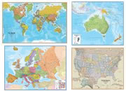 |
Wall Maps |
 |
Map of the Ten Largest Deserts |
 |
What Is An Archipelago? |

Find Other Topics on Geology.com:

|

| ||

|

| ||

|

| ||

|

|