Home » World Maps » Africa » Cote d'Ivoire (Ivory Coast)
Cote d'Ivoire (Ivory Coast) Map and Satellite Image
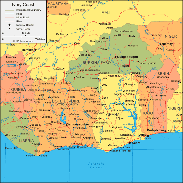
| Cote d'Ivoire (Ivory Coast) is located in western Africa. Cote d'Ivoire is bordered by the Gulf of Guinea to the south, Liberia and Guinea to the west, Mali and Burkina Faso to the north, and Ghana to the east. |
ADVERTISEMENT
Cote d'Ivoire Bordering Countries:
Burkina Faso, Ghana, Guinea, Liberia, MaliRegional Maps:
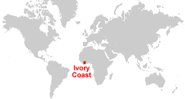
Map of Africa, World MapWhere is Cote d'Ivoire?
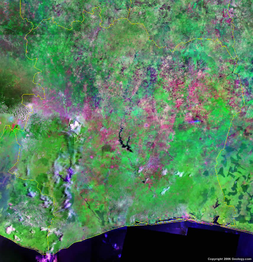
Cote d'Ivoire Satellite Image
ADVERTISEMENT

Explore Cote d'Ivoire Using Google Earth:
Google Earth is a free program from Google that allows you to explore satellite images showing the cities and landscapes of Cote d'Ivoire and all of Africa in fantastic detail. It works on your desktop computer, tablet, or mobile phone. The images in many areas are detailed enough that you can see houses, vehicles and even people on a city street. Google Earth is free and easy-to-use.
Cote d'Ivoire on a World Wall Map:
Cote d'Ivoire is one of nearly 200 countries illustrated on our Blue Ocean Laminated Map of the World. This map shows a combination of political and physical features. It includes country boundaries, major cities, major mountains in shaded relief, ocean depth in blue color gradient, along with many other features. This is a great map for students, schools, offices and anywhere that a nice map of the world is needed for education, display, or decor.
Cote d'Ivoire On a Large Wall Map of Africa:
If you are interested in Cote d'Ivoire and the geography of Africa, our large laminated map of Africa might be just what you need. It is a large political map of Africa that also shows many of the continent's physical features in color or shaded relief. Major lakes, rivers, cities, roads, country boundaries, coastlines and surrounding islands are all shown on the map.Cote d'Ivoire Cities:
Abengourou, Abidjan, Aboisso, Adzope, Agboville, Bako, Beoumi, Biankouma, Bouafle, Bouake, Bouna, Boundiali, Buyo, Daloa, Danane, Dimbokro, Divo, Ferkessedougou, Fresco, Gagnoa, Grand-Bassam, Guiglo, Issia, Kani, Katiola, Kimbirila, Korhogo, Koro, Koutouba, Leraba, Loho, Man, Morondo, Nassian, Odienne, Oume, Samatiguila, San Pedro, Sarhala, Sassandra, Segeula, Soubre, Tabou, Tafire, Tai, Toranou, Varale, Vavoua, Yamoussoukro and Zinguinasso.Cote d'Ivoire Locations:
Bandama River, Canal de Vridi, Cavally River, Gulf of Guinew, Komoe River, Lac de Kossou, Laguna Aby, Lake Ebrie, Nzi River and Sassandra River.Cote d'Ivoire Natural Resources:
Cote d'Ivoire has fuel resources that include petroleum, natural gas and hydropower. The metallic resources include manganese, bauxite, cobalt, copper, gold, nickel, iron ore and tantalum. A variety of other resources for Cote d'Ivoire include diamonds, silica sand, clay, cocoa beans, coffee and palm oil.Cote d'Ivoire Natural Hazards:
Torrential flooding during the rainy season is a potential problem for Cote d'Ivoire. Other natural hazards include the coast's heavy surf and lack of natural harbors.Cote d'Ivoire Environmental Issues:
Cote d'Ivoire, or Ivory Coast, has water pollution from sewage, industrial and agricultural effluents. Deforestation is another environmental issue, as most of this country's forests (at one time the largest in West Africa) have been heavily logged.
ADVERTISEMENT