Home » World Maps » Africa » Sierra Leone
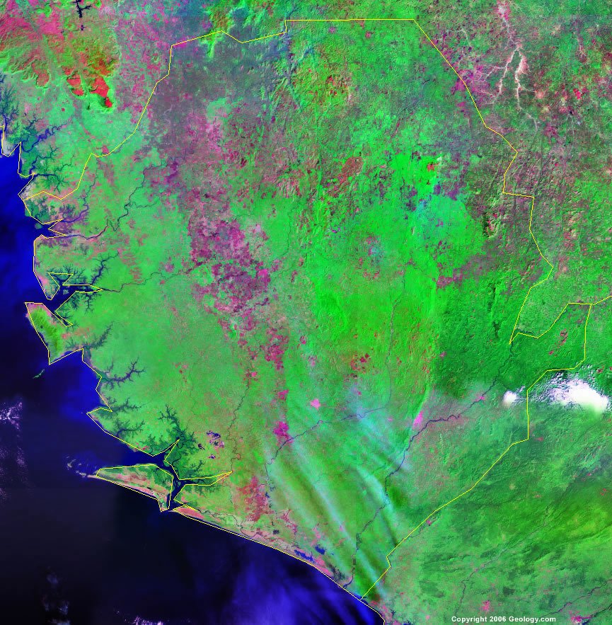
Sierra Leone Map and Satellite Image
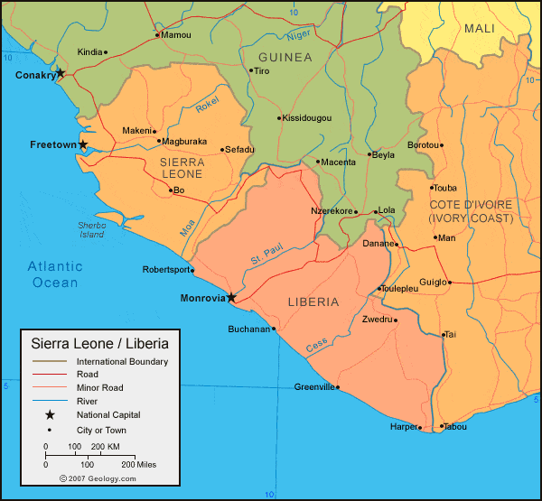
| Sierra Leone is located in western Africa. Sierra Leone is bordered by the Atlantic Ocean to the west, Guinea to the north and east, and Liberia to the south. |
ADVERTISEMENT
Sierra Leone Bordering Countries:
Guinea, LiberiaRegional Maps:
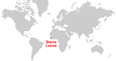
Map of Africa, World MapWhere is Sierra Leone?
Sierra Leone Satellite Image
ADVERTISEMENT

Explore Sierra Leone Using Google Earth:
Google Earth is a free program from Google that allows you to explore satellite images showing the cities and landscapes of Sierra Leone and all of Africa in fantastic detail. It works on your desktop computer, tablet, or mobile phone. The images in many areas are detailed enough that you can see houses, vehicles and even people on a city street. Google Earth is free and easy-to-use.
Sierra Leone on a World Wall Map:
Sierra Leone is one of nearly 200 countries illustrated on our Blue Ocean Laminated Map of the World. This map shows a combination of political and physical features. It includes country boundaries, major cities, major mountains in shaded relief, ocean depth in blue color gradient, along with many other features. This is a great map for students, schools, offices and anywhere that a nice map of the world is needed for education, display or decor.
Sierra Leone On a Large Wall Map of Africa:
If you are interested in Sierra Leone and the geography of Africa our large laminated map of Africa might be just what you need. It is a large political map of Africa that also shows many of the continent's physical features in color or shaded relief. Major lakes, rivers, cities, roads, country boundaries, coastlines and surrounding islands are all shown on the map.Sierra Leone Cities:
Bauya, Bo, Bonthe, Freetown, Kailahun, Kamalu, Kambia, Kenema, Koidu, Lungi, Lunsar, Magburaka, Makeni, Panguma, Pendembu, Port Loko, Pujehun, Sefadu, Sulima, Sumbuya, Taigbe, Waterloo, Yana and Zimmi.Sierra Leone Locations:
Atlantic Ocean, Great Scarcies River, Loma Mountains, Mano River, Moa River, Moro River, Rokel River, Sherbo Island, Sherbro River and Yawri Bay.Sierra Leone Natural Resources:
Sierra Leone has important mineral resources, which include diamonds, iron ore, titanium ore, bauxite, chromite and gold.Sierra Leone Natural Hazards:
In Sierra Leone the dry, sand-laden harmattan winds blow in from the Sahara during December through February. Other natural hazards for this country include dust storms and sandstorms.Sierra Leone Environmental Issues:
Sierra Leone has had rapid population growth, which is pressuring the environment. There is a problem with overfishing. In addition, a civil war has depleted the natural resources. Other environmental issues include overharvesting of timber, expansion of cattle grazing, and slash-and-burn agriculture. All of these have resulted in deforestation and soil exhaustion.
ADVERTISEMENT