Home » World Maps » Africa » Uganda
Uganda Map and Satellite Image
| Uganda is located in eastern Africa. Uganda is bordered by South Sudan to the north, Kenya to the east, Tanzania and Rwanda to the south, and the Democratic Republic of the Congo to the west. |
ADVERTISEMENT
Uganda Bordering Countries:
Democratic Republic of the Congo, Kenya, Rwanda, South Sudan, TanzaniaRegional Maps:
Map of Africa, World MapWhere is Uganda?
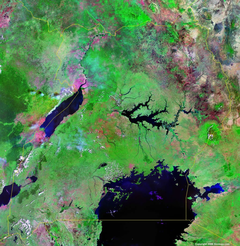
Uganda Satellite Image
ADVERTISEMENT

Explore Uganda Using Google Earth:
Google Earth is a free program from Google that allows you to explore satellite images showing the cities and landscapes of Uganda and all of Africa in fantastic detail. It works on your desktop computer, tablet, or mobile phone. The images in many areas are detailed enough that you can see houses, vehicles and even people on a city street. Google Earth is free and easy-to-use.
Uganda on a World Wall Map:
Uganda is one of nearly 200 countries illustrated on our Blue Ocean Laminated Map of the World. This map shows a combination of political and physical features. It includes country boundaries, major cities, major mountains in shaded relief, ocean depth in blue color gradient, along with many other features. This is a great map for students, schools, offices and anywhere that a nice map of the world is needed for education, display or decor.
Uganda On a Large Wall Map of Africa:
If you are interested in Uganda and the geography of Africa our large laminated map of Africa might be just what you need. It is a large political map of Africa that also shows many of the continent's physical features in color or shaded relief. Major lakes, rivers, cities, roads, country boundaries, coastlines and surrounding islands are all shown on the map.Uganda Cities:
Arua, Atura, Entebbe, Gulu, Jinja, Kaabong, Kampala, Kasese, Katakwi, Katera, Kiboga, Kisoro, Kitgum, Kotido, Kumi, Lira, Madi Opei, Masaka, Masindi, Mbale, Mbarara, Moroto, Moyo, Mubende, Nimule, Orungo, Pabo, Pajule, Pakwach, Rukungiri, Sanje, Soroti and Tororo.Uganda Locations:
Achwa River, Albert Nile River, Katonga River, Kazinga Channel, Lake Albert, Lake Edward, Lake George, Lake Kwania, Lake Kyoga, Lake Salisbury, Lake Victoria, Mt. Elgon and Victoria Nile River.Uganda Natural Resources:
Uganda's various natural resources include copper, cobalt, limestone, salt, hydropower and arable land.Uganda Natural Hazards:
Natural hazards in Uganda include both droughts and flooding, earthquakes and landslides, and hailstorms.Uganda Environmental Issues:
Environmental issues for Uganda include deforestation, overgrazing, and soil erosion. The country's wetlands are being drained for agricultural use. Lake Victoria is affected by industrial water pollution and an infestation of water hyacinth. Uganda also has widespread poaching.
ADVERTISEMENT