Home » Pangaea Supercontinent
Pangaea Supercontinent
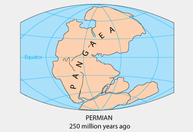
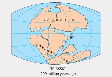
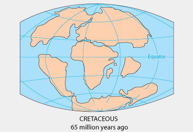
"Supercontinent" is a term used for a large landmass formed by the convergence of multiple continents. The most frequently referenced supercontinent is known as "Pangaea" (also "Pangea"), which existed approximately 225 million years ago. It is thought that all major continents at that time were assembled into the Pangaea supercontinent.
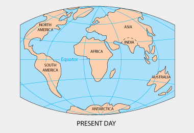
The supercontinent of Pangaea subsequently fragmented, and the pieces now account for Earth's current continents. The geography of Pangaea and the more recent continent movements are shown in the map sequence on this page. Maps by USGS.
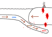
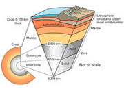
The theory of plate tectonics provides an explanation for these continent movements. According to this theory, Earth's outer shell is divided into a series of plates. These plates consist of the crust and a small amount of the underlying mantle. The plates slide over a weak zone in the mantle at a rate of a few centimeters per year. Convection currents in the mantle, caused by the escape of heat from Earth's interior, are what drives the movement of these plates.
ADVERTISEMENT
Maps on this page by USGS.
If you study the maps on this page, you will see that the Atlantic Ocean is getting wider as a result of the plate movement. Also, the Pacific Ocean is closing. A new supercontinent might form when the Pacific Ocean completely closes and the continents surrounding it converge.
The current continent of Eurasia could be considered a supercontinent. The Ural Mountains separate Europe from Asia and mark a line of compression and deformation where the two continents crushed into one another.
Find Other Topics on Geology.com:
 | Rocks: Galleries of igneous, sedimentary and metamorphic rock photos with descriptions. |
|
 | Minerals: Information about ore minerals, gem materials and rock-forming minerals. |
|
 | Volcanoes: Articles about volcanoes, volcanic hazards and eruptions past and present. |
|
 | Gemstones: Colorful images and articles about diamonds and colored stones. |
|
 | General Geology: Articles about geysers, maars, deltas, rifts, salt domes, water, and much more! |
|
 | Geology Store: Hammers, field bags, hand lenses, maps, books, hardness picks, gold pans. |
|

|
 | Diamonds: Learn about the properties of diamond, its many uses, and diamond discoveries.
|
|