Home » World Maps » Canada » Quebec
Quebec Map - Quebec Satellite Image

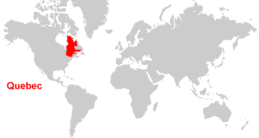
| Quebec is located in eastern Canada. Quebec is bordered by the Hudson Bay to the west, Newfoundland and Labrador to the east, Ontario to the west and south, and the United States and New Brunswick to the south. |
ADVERTISEMENT
Quebec Bordering Provinces/Territories:
New Brunswick, Newfoundland and Labrador, OntarioRegional Maps:
Map of Canada, World MapWhere is Quebec?
Quebec Satellite Image
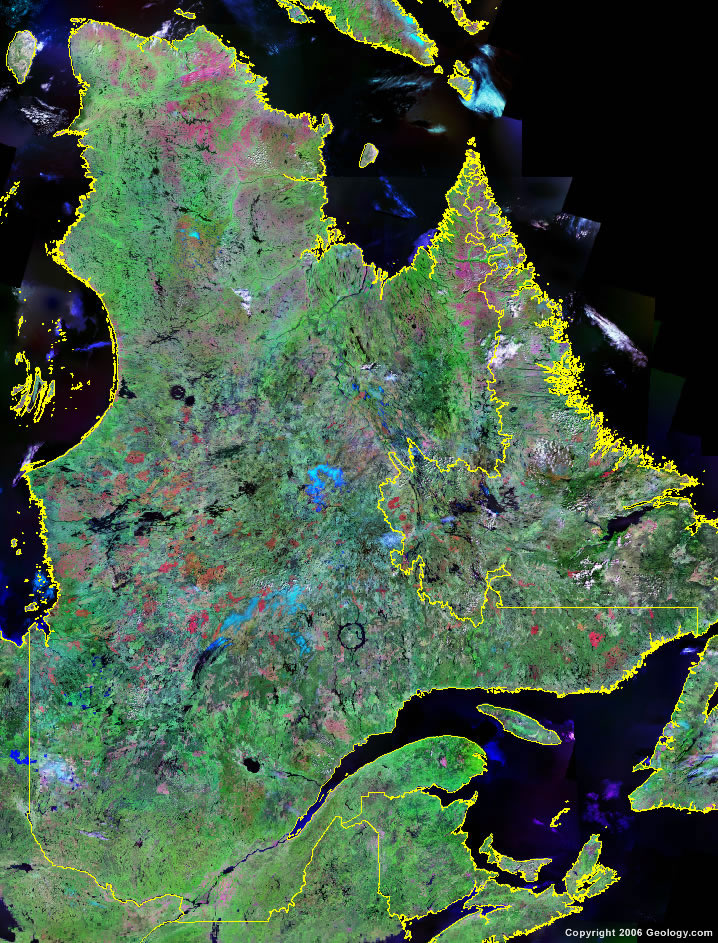
Click for high-resolution image.
ADVERTISEMENT

Explore Quebec, Canada Using Google Earth
Google Earth is a free program from Google that allows you to explore satellite images showing the cities and landscapes of Quebec and all of North America in fantastic detail. It works on your desktop computer, tablet, or mobile phone. The images in many areas are detailed enough that you can see houses, vehicles and even people on a city street. Google Earth is free and easy-to-use.
Canada Topo Maps
Get a custom printed large-format Canadian Topographic Map on waterproof, laminated or glossy paper. You can center the map anywhere in Canada that you want and adjust the scale with easy-to-use tools on the MyTopo website. They will then print and ship your map rolled in a tube or folded neatly in an envelope - your choice.
Quebec, Canada on a World Wall Map
Canada is one of nearly 200 countries illustrated on our Blue Ocean Laminated Map of the World. The Canadian province and territory boundaries are shown on the map along with other political and physical features. It displays symbols for major cities. Major mountains are shown in shaded relief. Ocean depths are indicated with a blue color gradient. This is a great map for students, schools, offices and anywhere that a nice map of the world is needed for education, display or decor.
Quebec, Canada On a Large Wall Map of North America
If you are interested in Quebec and the geography of Canada, our large laminated map of North America might be just what you need. It is a large political map of North America that also shows many of the continent's physical features in color and shaded relief. Major lakes, rivers, cities, roads, country/province/territory boundaries, coastlines and surrounding islands are all shown on the map.Quebec Cities:
Alma, Baie-Comeau, Baie-des-Ha!-Ha!, Bale-Trinite, Beauceville, Beauport, Blanc-Sablon, Brande-Riviere, Cabano, Cap-Chat, Charlesbourg, Chibougamau, Chicoutimi, Cobalt, Drummondville, Forestville, Gaspe, Gatineau, Hauterive, Inukjuak, Joliette, Jonqulere, La Malbaie, La Pocatiere, La Tuque, LaSalle, Lauzon, Laval, Longueuil, Magog, Magpie, Maniwaki, Matagami, Matane, Mingan, Mont-Laurier, Montreal, Perce, Pointe-Parent, Port-Cartier, port-Menier, Quebec, Rimouski, Rouyn-Noranda, Saint-Felicien, Schefferville, Sept-Iles, Shawinigan, Sherbrooke, St. Georges, St.-Augustin, Temiscaming, Thetford-Mines, Trois-Rivieres, Val-d'Or, and Wolf Bay.Quebec Lakes, Rivers and Locations:
Arnaud River, Bell River, Chaleur Bay, George River, Gulf of St. Lawrence, Harricana River, Hudson Bay, Hudson Strait, Jacques Cartier Passage, James Bay, Koroc River, Lac Albanel, Lac Bienville, Lac Brule, Lac Klotz, Lac Magpie, Lac Manouane, Lac Minto, Lac Mistassini, Lac Nantais, Lac Naococane, Lac Nichicun, Lac Payne, Lac St. Pierre, Lac St.-Jean, Lake Abitibi, Lake Burton, Ottaw River, Peribonca River, Povungnituk River, River aux Feuilles, Reservoir Cabonga, Reservoir Gouin, St Lawrence River, Ste. Marguerite River, Ungava Bay, and Wheeler River.