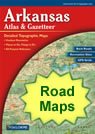
Home » US Maps » Arkansas » Roads and Cities
Map of Arkansas Cities and Roads

ADVERTISEMENT
City Maps for Neighboring States:
Louisiana Mississippi Missouri Oklahoma Tennessee Texas


Arkansas Cities:
Cities with populations over 10,000 include: Arkadelphia, Benton, Bentonville, Blytheville, Cabot, Camden, Conway, El Dorado, Fayetteville, Forrest City, Fort Smith, Harrison, Hot Springs, Jacksonville, Jonesboro, Little Rock, Magnolia, Mountain Home, North Little Rock, Paragould, Pine Bluff, Rogers, Russellville, Searcy, Sherwood, Siloam Springs, Springdale, Texarkana, Van Buren and West Memphis.
Arkansas Interstates:
North-South interstates include: Interstate 55. East-West interstates include: Interstate 30 and Interstate 40.
Arkansas Routes:
US Highways and State Routes include: Route 49, Route 62, Route 63, Route 64, Route 65, Route 67, Route 70, Route 71, Route 79, Route 82, Route 165, Route 167, Route 270, Route 412 and Route 425.
ADVERTISEMENT

