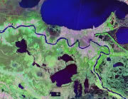
Home » US Maps » Louisiana » Roads and Cities
Map of Louisiana Cities and Roads

ADVERTISEMENT
City Maps for Neighboring States:
Arkansas Mississippi Texas


Louisiana Cities:
Cities with populations over 10,000 include: Abbeville, Alexandria, Baker, Bastrop, Baton Rouge, Bogalusa, Bossier City, Chalmette, Crowley, De Ridder, Eunice, Gretna, Hammond, Houma, Jennings, Kenner, Lafayette, Lake Charles, Minden, Monroe, Morgan City, Natchitoches, New Iberia, New Orleans, Opelousas, Pineville, Ruston, Shreveport, Slidell, Sulphur, Thibodaux, West Monroe, Westwego and Zachary.
Louisiana Interstates:
North-South interstates include: Interstate 49 and Interstate 55. East-West interstates include: Interstate 10, Interstate 12 and Interstate 20.
Louisiana Routes:
US Highways and State Routes include: Route 61, Route 65, Route 71, Route 79, Route 80, Route 84, Route 90, Route 165, Route 167, Route 171 and Route 190.
ADVERTISEMENT

