Home » US Maps » Rhode Island » Roads and Cities
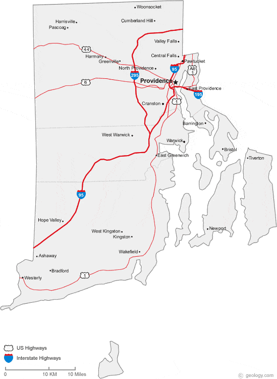
Map of Rhode Island Cities and Roads
ADVERTISEMENT
City Maps for Neighboring States:
Connecticut Massachusetts


Rhode Island Cities:
Cities with populations over 10,000 include: Barrington, Bristol, Central Falls, Cranston, East Providence, Newport, North Providence, Pawtucket, Providence, Valley Falls, Warwick, West Warwick, Westerly and Woonsocket.
Rhode Island Interstates:
North-South interstates include: Interstate 95 and Interstate 295.
Rhode Island Routes:
US Highways and State Routes include: Route 1, Route 1A, Route 6 and Route 44.
ADVERTISEMENT

