Home » US Maps » New Hampshire » County Map
New Hampshire County Map with County Seat Cities

ADVERTISEMENT
County Maps for Neighboring States:
Maine Massachusetts Vermont


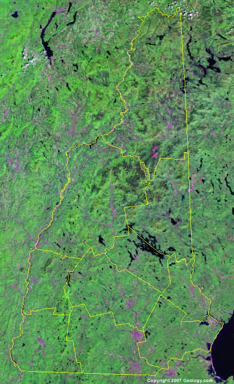
The map above is a Landsat satellite image of New Hampshire with County boundaries superimposed. We have a more detailed satellite image of New Hampshire without County boundaries.


ADVERTISEMENT
New Hampshire Counties and County Seats |
|
|
Belknap County - Laconia Carroll County - Ossipee Cheshire County - Keene Coos County - Lancaster Grafton County - North Haverhill |
Hillsborough County - Nashua Merrimack County - Concord Rockingham County - Brentwood Strafford County - Dover Sullivan County - Newport |
