Home » US Maps » Pennsylvania » County Map
Pennsylvania County Map with County Seat Cities

ADVERTISEMENT
County Maps for Neighboring States:
Delaware Maryland New Jersey New York Ohio West Virginia
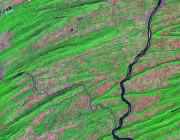


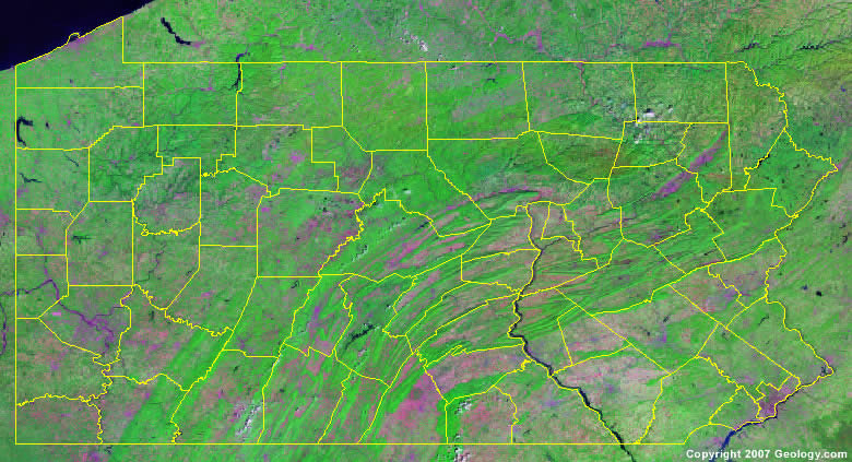
The map above is a Landsat satellite image of Pennsylvania with County boundaries superimposed. We have a more detailed satellite image of Pennsylvania without County boundaries.


ADVERTISEMENT
Pennsylvania Counties and County Seats |
|
|
Adams County - Gettysburg Allegheny County - Pittsburgh Armstrong County - Kittanning Beaver County - Beaver Bedford County - Bedford Berks County - Reading Blair County - Hollidaysburg Bradford County - Towanda Bucks County - Doylestown Butler County - Butler Cambria County - Ebensburg Cameron County - Emporium Carbon County - Jim Thorpe Centre County - Bellefonte Chester County - West Chester Clarion County - Clarion Clearfield County - Clearfield Clinton County - Lock Haven Columbia County - Bloomsburg Crawford County - Meadville Cumberland County - Carlisle Dauphin County - Harrisburg Delaware County - Media Elk County - Ridgway Erie County - Erie Fayette County - Uniontown Forest County - Tionesta Franklin County - Chambersburg Fulton County - McConnellsburg Greene County - Waynesburg Huntingdon County - Huntingdon Indiana County - Indiana Jefferson County - Brookville Juniata County - Mifflintown |
Lackawanna County - Scranton Lancaster County - Lancaster Lawrence County - New Castle Lebanon County - Lebanon Lehigh County - Allentown Luzerne County - Wilkes-Barre Lycoming County - Williamsport McKean County - Smethport Mercer County - Mercer Mifflin County - Lewistown Monroe County - Stroudsburg Montgomery County - Norristown Montour County - Danville Northampton County - Easton Northumberland County - Sunbury Perry County - New Bloomfield Philadelphia County - Philadelphia Pike County - Milford Potter County - Coudersport Schuylkill County - Pottsville Snyder County - Middleburg Somerset County - Somerset Sullivan County - Laporte Susquehanna County - Montrose Tioga County - Wellsboro Union County - Lewisburg Venango County - Franklin Warren County - Warren Washington County - Washington Wayne County - Honesdale Westmoreland County - Greensburg Wyoming County - Tunkhannock York County - York |
